Golden Gravel Trail


The Golden Gravel Trail is a DIGITAL-ONLY route. No paper maps are produced. This route is available digitally here.
A Golden Trail for a Golden Anniversary
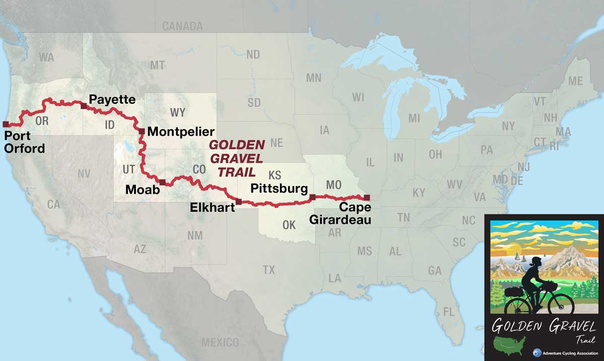
The Golden Gravel Trail was created in 2026 to celebrate Adventure Cycling Association’s 50th “golden” anniversary, redefining what long-distance, off-road bikepacking can look like in the United States. Spanning eight states—Missouri, Kansas, Oklahoma, Colorado, Utah, Wyoming, Idaho, and Oregon—this groundbreaking route stretches 3,805 miles (6,124 km) from the banks of the Mississippi River to the crashing waves of the Pacific Ocean. Along the way, riders experience the full spectrum of American landscapes: the rolling Ozark hills, the vast Great Plains, challenging alpine passes, rugged canyon country, and high desert basins before descending through lush coastal forests to the dramatic Pacific shoreline.
This mixed-surface adventure combines the technical challenge of primarily off-road riding with the soul-stirring diversity of America’s most iconic terrain. Built through meticulous research and local partnerships, the Golden Gravel Trail is the ultimate celebration of adventure, endurance, and the transformative power of bicycle travel.

Taking the Long Way West
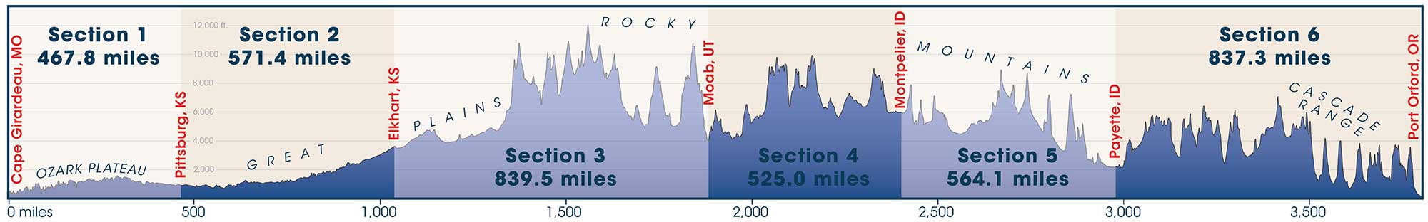
At a whopping 3,805 miles (6,124 km), the Golden Gravel Trail is the longest route we have published since our Northern Tier Bicycle Route debuted in 1984. It’s also our longest off-road cycling route ever—stretching 700 miles (1,120 km) longer than our legendary Great Divide Mountain Bike Route!
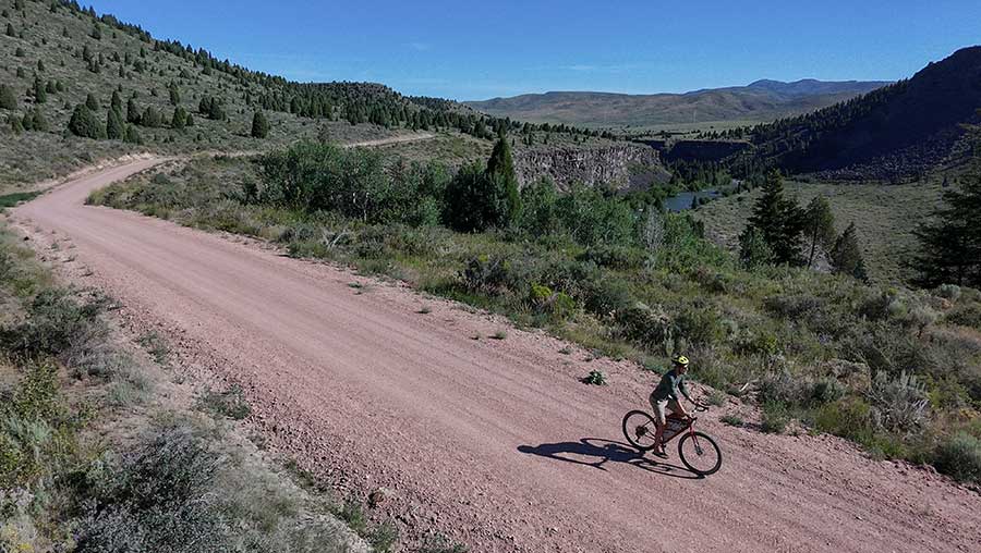
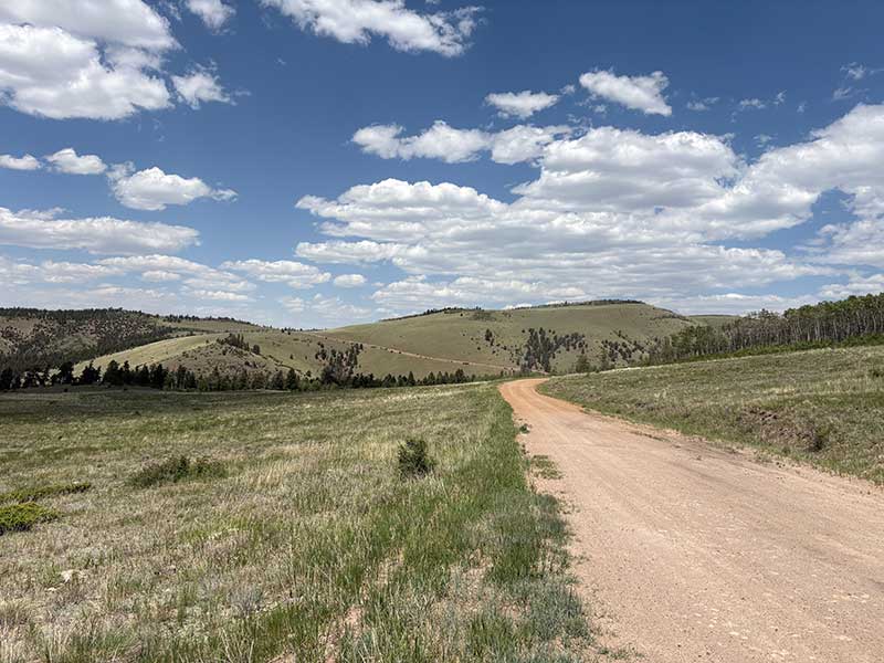
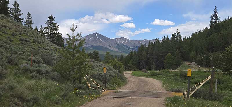
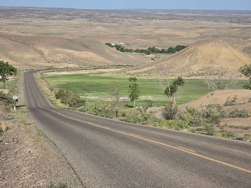
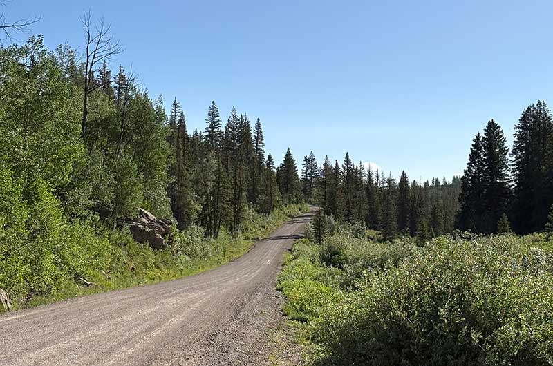
Extensive miles mean endless scenery, and the Golden Gravel Trail delivers it all. The route begins in Cape Girardeau, Missouri on the banks of the mighty Mississippi River, quickly climbing into the forested hills of the Ozark Plateau. These lush woodlands gradually give way to the sweeping Great Plains, which dominate nearly a quarter of the trail’s total mileage from western Missouri into central Colorado. Across these vast grasslands, the terrain grows increasingly arid, and resupply towns become more distant, setting the stage for the route’s first monumental challenge: the Rocky Mountains.
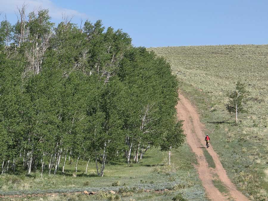
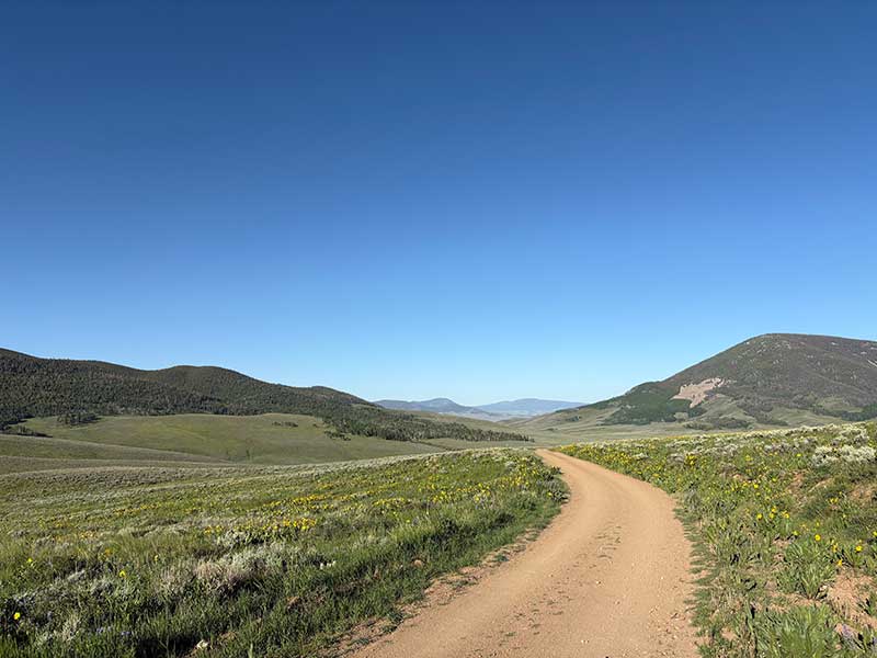
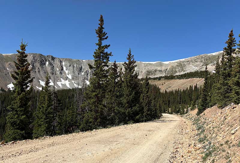
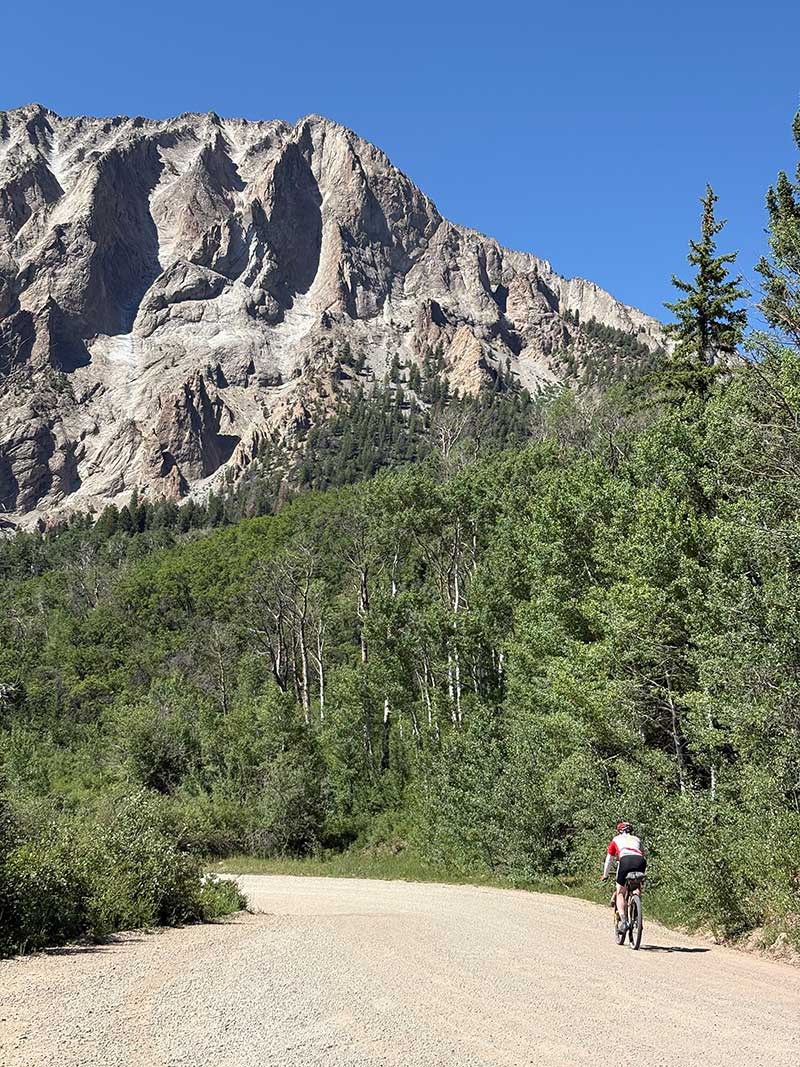
The route spends much of its length in Colorado, Utah, and Idaho traversing the various subranges of the Rockies, with its highest point reaching 12,034 ft. (3,668 m) above sea level at Cumberland Pass in Colorado. The Rocky Mountains vary in character by region but are broadly defined by long climbs, rocky terrain, and expansive, panoramic views. Riders will experience a mix of alpine meadows, dense forests, and high sagebrush basins, with each subrange offering its own distinct challenges and rewards.
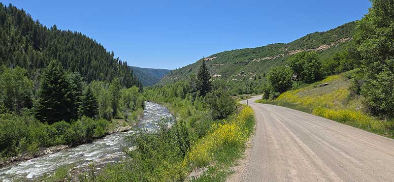
The route makes a brief detour from the Rockies to cross the Colorado Plateau, a vast desert region spreading across much of the Southwestern United States. Though this crossing marks a departure from the mountains, extreme remoteness, rugged terrain, and high exposure makes this stretch one of the most challenging of the entire trail. The effort comes with rich rewards however, as the unique landscapes around Moab and the San Rafael Swell in Utah rank among the most striking on the entire trail.
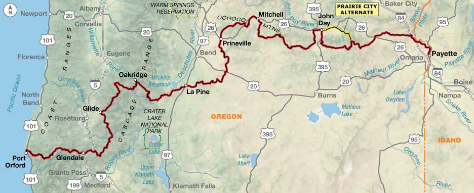
Oregon is the final state of the journey, carrying riders to the endpoint at the Pacific Ocean. The route leaves the Rocky Mountains just before entering Oregon, but that doesn’t mean the climbing is over—in fact, Oregon has the highest average climb per mile of any state along the trail.
Eastern Oregon is mountainous and arid, stretching across endless sagebrush basins, grasslands, and pine forests. Farther west, the landscape transforms dramatically as the route climbs into the Cascades and Coast Ranges. These mountains receive higher annual precipitation, which nourishes dense forests and creates a lush green contrast to the high desert of eastern Oregon.
The route culminates in the small town of Port Orford, perched on a bluff overlooking the vast Pacific Ocean. After admiring the sweeping view, riders can make their way down to the crashing waves, dip their tires in the water, and savor the accomplishment of completing the epic Golden Gravel Trail.
Designed for the Long Haul
The Golden Gravel Trail was created specifically for long-distance bicycle tourists, designed to strike a careful balance—challenging but never too punishing just for the sake of difficulty. That said, riders will encounter their fair share of sustained climbs, rugged terrain, and variable—sometimes extreme—weather conditions across its 3,805 miles (6,124 km).
The route avoids technical singletrack entirely, primarily following well-maintained gravel roads and low-traffic paved roads, making it relatively accessible while still demanding strong fitness, careful preparation, and resilience. Particularly rugged sections are clearly marked on the map, giving riders the chance to prepare mentally, physically, and mechanically before tackling them.
Much of the route is extremely remote, but resupply points are intentionally spaced, with distances between services increasing as the route moves west. Riders should be prepared to carry two to three days’ worth of food across some of the most isolated sections, and up to a day’s worth of water—or more—through the more arid stretches.
Good luck, have fun, and don’t hesitate to give us a call with your feedback! We think you’re going to love every mile.
Photo by Jeremy Nolan
TERRAIN
At 3,805 miles (6,124 km), the Golden Gravel Trail traverses nearly every landscape found in the continental United States: forested plateaus, agricultural plains, vast grasslands, high mountain ranges, low river valleys, arid desert, sagebrush steppe, and lush temperate rainforest. The result is a route defined by extraordinary geographic diversity that showcases some of the most stunning natural scenery in the American West.
The route begins at just 340 ft. (104 m) above sea level on the banks of the Mississippi River in Cape Girardeau, Missouri. The first stretch through Missouri crosses the Ozark Plateau, a broad, forested uplift of eroded mountains and river valleys. The Ozarks are mild compared to what lies ahead, serving as a gentle warm-up for the westbound journey. While some short stretches can be steep, individual climbs rarely exceed 400 ft. (122 m) before descending.
Rolling, hilly terrain in Missouri. Photo by John Hormell.
Entering Kansas, continuing through Oklahoma, and into eastern Colorado, the route crosses the vast Great Plains. For nearly 1,000 miles (1,600 km), the terrain is largely flat, with only gentle hills as the trail gradually rises westward toward the base of the Rocky Mountains.
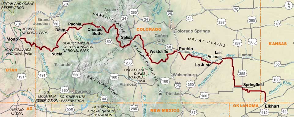
Beginning in Pueblo, Colorado, the character of the route changes dramatically. Through the Rockies, riders will encounter multiple long, steep climbs over alpine passes and extended descents into the valleys and canyons below. This mountainous rhythm continues all the way to the Pacific Ocean, crossing Colorado, Utah, Wyoming, Idaho, and into the final state of Oregon, where the route leaves the Rockies to traverse the Cascades and Coast Ranges.
A steep climb in Colorado. Photo by Carl Gable.
The route crosses the Continental Divide in Colorado at Marshall Pass (elev. 10,842 ft./3,305 m) and reaches its highest point at Cumberland Pass (elev. 12,034 ft./3,668 m), also in Colorado. Be sure to stay hydrated, wear sun protection, and take your time adjusting to these extreme altitudes.
In western Colorado and eastern Utah, the route enters the arid desert of the Colorado Plateau. After the significant climb over the La Sal Mountains, the terrain softens somewhat across the desert, but remoteness, exposure, and rocky and sandy road conditions more than compensate for the gentler grades. The scenery is spectacular, especially near Moab and within the San Rafael Swell.
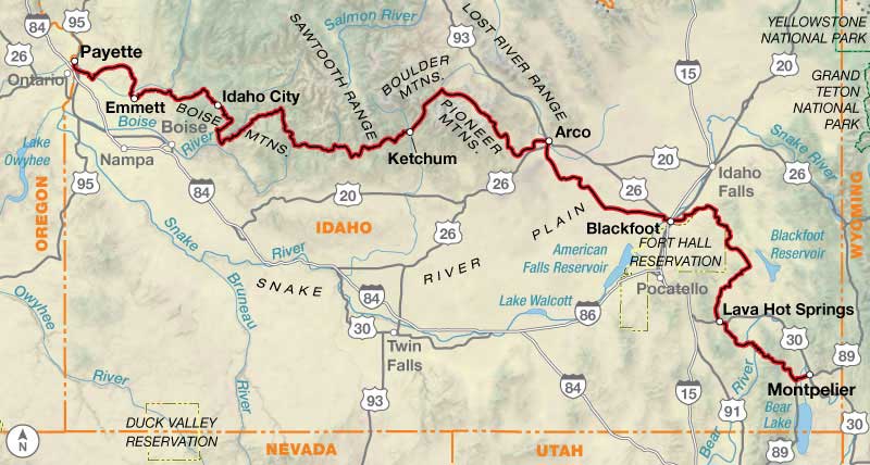
Continuing north through Utah, Wyoming, and into Idaho, the route returns to mountainous terrain interspersed with broad valleys. While not as high as Colorado, this section still reaches significant elevations, with several stretches climbing above 8,000 ft. (2400 m).
The crossing of the Snake River Plain in Idaho marks the flattest stretch of the route since leaving the Great Plains. The respite is brief, however, as the trail soon returns to some of the steepest climbs of the entire route. Antelope Pass, just west of Arco, is particularly rough—steep, rocky, and fully exposed to wind and sun.
Oregon marks a slight drop in elevation, with few stretches rising above 6,000 ft. (1800 m). Don’t be fooled though—Oregon also holds the distinction of the highest average climb per mile on the entire route. Nearly the entire state consists of either climbing or descending as the route winds through the Strawberry Mountains, Aldrich Mountains, Ochoco Mountains, Cascades, and Coast Ranges. The route concludes at the Pacific Ocean in Port Orford, only a few feet above sea level.
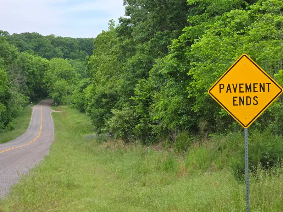
Approximately 70% of the route is on unpaved roads, with most of the remaining 30% on low-traffic paved roads and bike paths. Only a small fraction of the route travels on high-traffic roads, mainly for access to services or connectivity purposes. Make yourself visible and practice defensive riding on these short sections. All three alternates—Sevenmile Canyon, Unicorn Ridge, and Prairie City—are fully paved and provide easier options through otherwise challenging terrain.
Pavement does not always mean heavy traffic—many paved roads along the route see very few vehicles, such as this quiet stretch in Oregon. Photo by Jeremy Nolan.
| Golden Gravel Trail - Main Route | ||||
|---|---|---|---|---|
| Section | Distance | Elevation | Total Climb | Avg. Climb/mile |
| Total | 3,805.5 miles | Minimum: 29 ft.Maximum:12,034 ft. | 240,180 ft. west bound238,428 ft. east bound | 63 ft. per mi. west bound63 ft. per mi. east bound |
| 1 | 467.8 miles | Minimum: 340 ft.Maximum:1,589 ft. | 28,279 ft. west bound27,140 ft. east bound | 60 ft. per mi. west bound58 ft. per mi. east bound |
| 2 | 571.4 miles | Minimum: 690 ft.Maximum:3,602 ft. | 17,504 ft. west bound15,057 ft. east bound | 31 ft. per mi. west bound26 ft. per mi. east bound |
| 3 | 839.5 miles | Minimum: 3,393 ft.Maximum:12,034 ft. | 54,112 ft. west bound53,450 ft. east bound | 64 ft. per mi. west bound64 ft. per mi. east bound |
| 4 | 525 miles | Minimum: 3,964 ft.Maximum:10,002 ft. | 37,621 ft. west bound34,696 ft. east bound | 72 ft. per mi. west bound66 ft. per mi. east bound |
| 5 | 564.1 miles | Minimum: 2,143 ft.Maximum:8,931 ft. | 35,368 ft. west bound39,241 ft. east bound | 63 ft. per mi. north bound70 ft. per mi. east bound |
| 6 | 837.7 miles | Minimum: 29 ft.Maximum:7,025 ft. | 67,296 ft. west bound68,844 ft. east bound | 80 ft. per mi. west bound82 ft. per mi. east bound |
| Golden Gravel Trail Alternates | ||||
|---|---|---|---|---|
| Name | Section | Distance | Total Climb | Avg. Climb/mile |
| Sevenmile Canyon Alternate | 4 | 9.7 miles | 1,086 ft. west bound175 ft. east bound | 112 ft. per mi. west bound18 ft. per mi. east bound |
| Unicorn Ridge Alternate | 4 | 28.2 miles | 3,418 ft. west bound2,028 ft. east bound | 121 ft. per mi. west bound72 ft. per mi. east bound |
| Prairie City Alternate | 6 | 37.7 miles | 1,302 ft. west bound3,267 ft. east bound | 35 ft. per mi. west bound87 ft. per mi. east bound |
LOGISTICS
Accessing the Route
The route begins in Cape Girardeau, Missouri, approximately 130 miles (209 km) south of the nearest major airport in St. Louis. Cape Girardeau is also served by a small regional airport, offering flights to Chicago, Dallas/Fort Worth, and Pensacola, Florida. Free long-term parking is available at the terminal year-round.
Pueblo, Colorado is the largest city on the route with a population of approximately 111,000. It also marks the dividing line between the flatter eastern portion and the mountainous western half of the route, making it a convenient jumping-off point for riders who wish to skip either of these distinct sections. Pueblo is served by a small regional airport with daily connections to Denver.
Further west, the route passes within a day’s ride of both Salt Lake City, Utah and Boise, Idaho. Both cities are major metropolitan areas with large international airports, offering convenient access to and from the route.
The route ends in Port Orford, Oregon at the Pacific Ocean. The nearest major airport is in Portland, nearly 300 miles (480 km) to the north. Smaller regional airports are located in Eugene and Medford, with the closest in North Bend 55 miles (88 km) to the north. Southwest Oregon Regional Airport in North Bend offers daily connections to San Francisco and Denver.
Section 2 of Adventure Cycling’s Pacific Coast Bicycle Route links North Bend and Port Orford, offering cyclists the opportunity to ride a short portion of Oregon’s dramatic coastline. The Coastal Express also provides bus service between North Bend and Port Orford, with bike racks available for up to two bicycles.
Which Direction to Ride
The Golden Gravel Trail was originally designed, scouted, and mapped in the westbound direction, but can be ridden in either direction. As might be expected, there are advantages and disadvantages to traveling both westbound and eastbound.
Beginning in Cape Girardeau and heading west allows riders to ease into the journey with the relatively gentle, rolling terrain of the Ozarks and Great Plains before encountering the more demanding climbs in the mountains of Colorado, Utah, Idaho, and Oregon. This progression provides hundreds of largely forgiving miles to build strength and endurance, saving the most challenging section for last. Oregon has the highest average climb per mile of any section, making it a fitting ending when legs are seasoned and confidence is high.
In addition to becoming physically more challenging as it heads west, the route also becomes logistically more demanding. With the slight exception of Colorado, the route grows increasingly remote the farther west it travels. Beginning in Missouri, small resupply towns appear every 20-50 miles (30-80 km), with few exceptions. By the time the route reaches Oregon, those distances stretch to 60-140 miles (100-225 km). More on this below in the “Access to Services” section.
The final reason for traveling westbound is largely subjective and purely aesthetic: it allows riders to save the most dramatic scenery for last, culminating in a more picturesque finale at the Pacific Ocean.
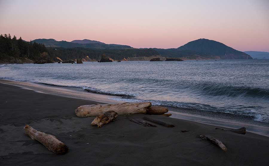
The Pacific Ocean at Port Orford, Oregon. Photo by Jeremy Nolan.
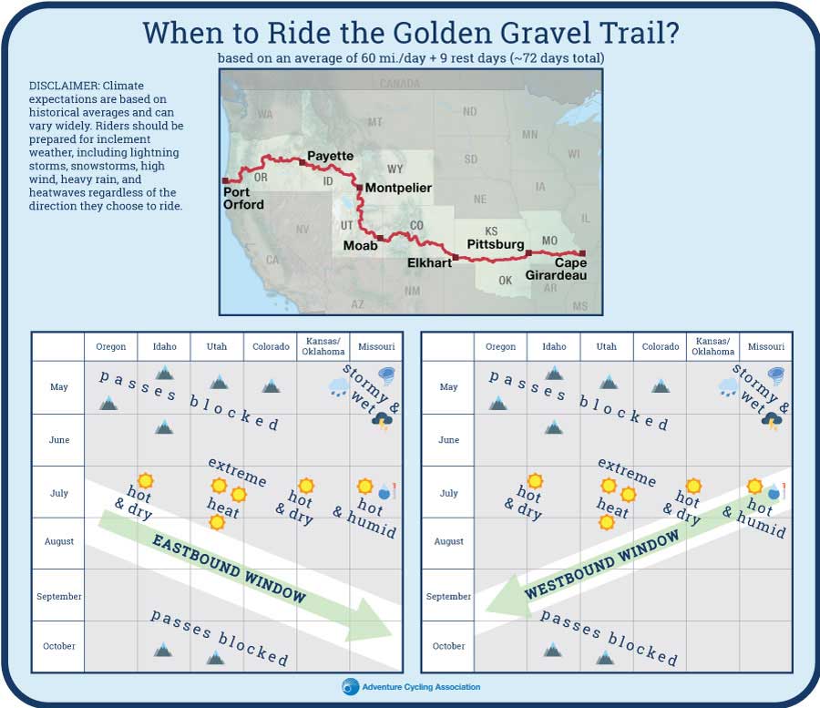
The primary drawback of riding westbound is timing the trip to align with favorable weather conditions. Stormy spring weather and frequent low-water crossings in Missouri make an early departure from Cape Girardeau inadvisable. Beginning in spring also means that by the time riders reach the mountain passes in Colorado in early summer, lingering snow may still pose a challenge. Even if the passes are clear, this timeline places riders in the Utah-Colorado desert in peak summer—when extreme heat, intense sun exposure, and limited access to water and shade make conditions particularly hazardous. Unfortunately, waiting until summer to depart Cape Girardeau, likely the overall best option, means facing hot, muggy conditions in the Midwest.
On the other hand, eastbound riders may find it easier to catch an ideal weather window. Departing from Port Orford, Oregon between mid-July and mid-August is more likely to place riders in each regional biome at just the right time: after the desert’s peak heat, before snow closes the high mountain passes, and well beyond the storms, high humidity, and hot temperatures of the Midwestern spring and summer. More on this below in the “When to Ride” section.
Another consideration—the scourge of every touring cyclist—is wind. While prevailing weather systems generally move from west to east across the continent, local winds are largely shaped by the passing pressure systems, surrounding terrain, and local vegetation. Do not fall for the common misconception that the wind will simply “blow you east” across the country. Riders can expect a mix of tailwinds, crosswinds, and headwinds regardless of the direction they travel. Generally speaking, average wind speed across the Great Plains—a notoriously windy region—tends to peak in spring and taper off into fall, with winds most often blowing from the south.
When to Ride
Based on an average of 60 miles (97 km) per day, plus one rest day per week, most riders will need approximately 72 days—about 2.5 months—to complete the full 3,805-mile (6,124 km) journey. The route’s geographic diversity, while one of its defining features, can also make completing it within a single season challenging, especially for westbound riders.
The best time to depart Cape Girardeau for a westbound trip is likely in July, after the stormy spring weather has subsided and low-water crossings are safe to cross. This timing places riders in the Utah desert in mid-to late August, when the extreme summer heat typically begins to ease.
A low-water crossing in Missouri. Photo by John Hormell.
If staying on schedule, riders should be able to cross the Rocky Mountains in Colorado, Utah, and Idaho before the first significant snowfall at higher elevations. Finally, riders will traverse the lower-elevation Cascade Mountains and Coast Ranges in Oregon in September or early October, when the weather is generally pleasant for cycling, aside from the potential for wildfire smoke.
Unfortunately, the schedule described above is not without compromise. Missouri in July can be very hot and humid, but it offers more shade and reliable water sources than the Utah desert, making it slightly preferable for peak summer riding. Mid- to late August in the Utah desert can still be quite hot, and riding from dawn to mid-morning may be the best strategy between Moab and Castle Dale to avoid the worst heat of the day.
The ideal climate window for eastbound riders is a bit more straightforward. The best time to depart from Port Orford is between mid-July and mid-August, resulting in an arrival in Cape Girardeau between late September and late October. This schedule is likely to place riders in each regional biome at just the right time: after the desert’s peak heat, before snow closes the high mountain passes, and well beyond the storms, humidity, and high temperatures of the Midwestern spring and summer.
This schedule is not without its drawbacks either—eastbound riders are still likely to encounter very high temperatures, particularly in eastern Oregon, across the Snake River Plain in Idaho, and in the Utah desert.
Obviously, climate predictions and daily riding distances are based on averages and will vary from year to year and rider to rider. Some years will be hotter, drier, wetter, or snowier than others, and some riders may average 40 miles per day while others average 80. Know your limits, monitor the weather, and plan ahead to ensure the most successful ride.
Access to Services
The Golden Gravel Trail relies primarily on small towns for resupply, most with populations ranging from a few hundred to a few thousand. Services vary widely, and riders will find themselves restocking at everything from rural gas stations to Walmart Supercenters. Flexibility with food choices and meal planning is essential.
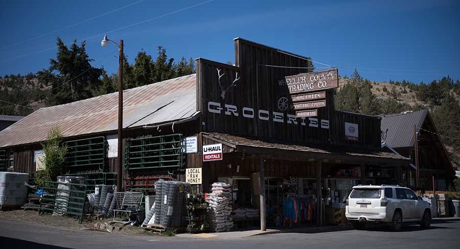
A small town grocery store in Mitchell, Oregon. Photo by Jeremy Nolan.
Pueblo, Colorado (population 111,000) is the largest city on the route by a considerable margin. Other “big” cities along the way include Cape Girardeau (MO), Pittsburg (KS), Liberal (KS), Delta (CO), Evanston (WY), Blackfoot (ID), Ontario (OR), and Prineville (OR). While the route deliberately avoids major metropolitan areas, it passes within a day’s ride of both Salt Lake City, Utah and Boise, Idaho.
With the slight exception of Colorado, the route grows increasingly remote the farther west it travels. Beginning in Missouri, small resupply towns appear every 20-50 miles (30-80 km), with few exceptions. By the time the route reaches Oregon, those distances stretch to 60-140 miles (100-225 km).
The longest stretch without a town on route is in Utah, between Orangeville and Park City— a 180-mile (290 km) span with only two remote convenience stores in between at Soldier Summit and Strawberry Bay. The longest stretch without any resupply services at all is in Oregon: 137 miles (225 km) between Huntington and John Day, though opting to take the Prairie City Alternate reduces this distance to 103 miles (166 km). Riders should be prepared to carry enough food to last two to three days when crossing these extended sections, but water can be regularly filtered from creeks and small lakes along the way.
East of the Rocky Mountains, a few long stretches without camping opportunities will necessitate spending the night in a hotel. West of the Rocky Mountains, the opposite is true: extended sections without lodging will require camping. For this reason, this route cannot realistically be ridden by camping every single night or staying indoors every night. As a result, riders—and their budgets—must remain flexible and adapt to the overnight options in each region. In some of the more tourist-oriented towns, such as Crested Butte (CO), Moab (UT), Park City (UT), and Ketchum (ID), indoor accommodations can be expensive and local campgrounds crowded, so plan accordingly. You may also wish to sign up with Warmshowers, a reciprocal hospitality site for bicycle travelers, for other overnight options.
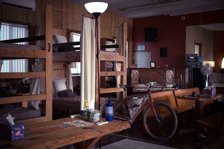
The Spoke’n Hostel in Mitchell, Oregon. Photo by Jeremy Nolan.
Campgrounds along the route range from primitive wilderness sites with picnic tables and vault toilets to full-scale commercial operations offering showers, flush toilets, and laundry facilities. All campgrounds shown on the map have been vetted to confirm that tent camping is permitted, as some RV parks restrict overnight stays to self-contained vehicles only. Policies can change, however, so it is wise to call ahead when planning to stay at a private campground and to make a reservation when possible.
In addition to established campgrounds, it is legal to disperse camp on USFS and BLM land for free following the guidelines found here: advcy.link/dispersecamp and advcy.link/blmdispersecamp.
Bike shops are few and far between along the route, and riders should be prepared for any mechanical possibility. At a minimum, carry basic bicycle tools, a tire pump, and spare tubes, even if riding tubeless.
Dispersed camping at Black Sage Pass in Gunnison National Forest in Colorado. Photo by Carl Gable.
Access to Water
Individual water sources are only marked on the map where water is scarce or not immediately obvious. Across much of Missouri, eastern Kansas, and eastern Oklahoma, wetter conditions and frequent towns and campgrounds with potable water make resupply generally straightforward. Riders should still refill whenever the opportunity arises and plan ahead for the occasional longer stretches between reliable sources.
Across the arid high plains of western Oklahoma, western Kansas, and eastern Colorado, piped water sources become much more limited. Surface water can be contaminated by agricultural runoff, oil and gas activity, cattle grazing, and heavy mineral content, so riders should plan to carry enough water between towns or campgrounds with potable water rather than relying on creeks, rivers, or lakes. Occasionally, filterable water can be found in stock tanks supplied by pumped wells, but these can run dry and should never be fully relied upon. Riders should be prepared to carry enough water to last upwards of 75 miles (121 km) throughout this region.
In the high-elevation alpine mountains of the Colorado Rockies, surface water is more common and can be filtered from natural springs, creeks, and lakes.
The Utah desert is likely the most concerning section of the entire route in terms of water availability, due to its extreme temperatures, remoteness, rugged terrain, and exposure. Reliable surface water between Moab and Green River (70 mi./113 km) and between Green River and Castle Dale (77 mi./124 km) is essentially nonexistent, though both of these stretches have paved options to slightly decrease this distance if desired. Riders should plan to carry enough water (up to 7-8 liters) to last the entire distance between towns if riding during extreme heat. Creeks, rivers, springs, and lakes should not be relied upon as primary water sources, even if they appear on a map, as they are usually dry or seasonal.
Arid, desolate, and exposed country between Green River and Castle Dale in Utah. Photo by Carl Gable.
Water availability throughout the remainder of Utah and the first portion of Idaho is generally manageable with careful planning. The next area of major concern is the 73-mile (117 km) stretch across the Snake River Plain between Blackfoot and Arco in Idaho. Beyond the residential and agricultural outskirts of Blackfoot, this section is rugged, exposed, dry, and desolate. Stock tanks marked on the map may provide some relief but should not be fully relied upon.
Stock tanks between Blackfoot and Arco in Idaho. Photo by Jeremy Nolan.
Water is not scarce again until eastern Oregon, between Prineville Reservoir and East Lake at Newberry Volcano, where no reliable water sources are available for 67 miles (108 km). Beyond this dry stretch, western Oregon offers abundant creeks, rivers, and lakes, making water relatively easy to find and filter with minimal planning.
Equipment & Gear
The Golden Gravel Trail is extremely hard on equipment. Over many hundreds of miles, the weight of loaded gear multiplies the stress on your bike, especially when repeatedly riding steep, rough, and dusty roads. Wheels, tires, and especially drivetrains (chains, cassettes, bottom brackets, and chainrings) absorb significant abuse and will likely need replacement over the course of the route.
Suspension components help mitigate the punishing nature of the terrain. That said, full-suspension bikes are often heavy and typically feature more suspension than this route requires, so they are not recommended. Suspension seatposts, quality handlebar grips with multiple hand positions, and front-suspension forks help smooth out miles of washboarded, bumpy, and pothole-ridden roads. Loading your bags to balance weight over a suspension fork and in the frame of the bike can work well, improving weight distribution without adding undue stress.
For the best overall ride experience, we recommend a gravel bike or hardtail mountain bike with tubeless tires between 2.2-2.6 inches wide. Suspension isn’t necessary for most of the route but is recommended to improve comfort on rougher sections. Sarah Swallow, who previewed the route from Oregon to western Colorado in summer 2025, rode an Otso Cycles Fenrir Ti Flat Bar with a Rockshox Sid SL Ultimate 3 P fork (110mm of travel), and 29×2.4” Teravail Camrock tires. You can find more descriptions of her gear and packing list here.
A fully loaded bike at the Continental Divide crossing at Monarch Pass, Colorado. CC Image courtesy of exploringwild.com.
High-quality camping gear is essential for the many nights spent outdoors in all types of weather, from cold rain and freezing temperatures to intense summer heat. A well-ventilated, freestanding, three-season tent with a rainfly, ample vestibule space, and a ground tarp footprint is a must. Sleeping bags should be rated to 20°F (-7°C) or lower, and an insulated sleeping pad is essential. Inflatable pads provide both added comfort and valuable insulation from the ground. Extra effort is needed to keep your possessions dry; pannier covers, dry bags, and plastic freezer bags all work well to protect clothing and gear from the elements. High-quality rain gear and sun-protective clothing are both absolutely essential.
A high-quality water filter or water treatment system (iodine tablets, etc.) is mandatory, and it’s essential for each person in your party to carry their own. Surface water should only be consumed after being filtered through a reliable water filter or treated properly.
Wildfire
Wildfire is a very real concern along the route, primarily between Colorado and Oregon, as evidenced by the large burn scars visible along the way. Fire season typically peaks from July through October— an unfortunate overlap with the ideal riding season. Wildfires can, and often do, close portions of the route for extended periods, sometimes with little notice. Flexibility and the ability to reroute on the fly are invaluable skills to have.
Because conditions vary significantly from year to year, riders should regularly monitor current wildfire activity through the National Interagency Fire Center at advcy.link/fireinfo or download the Watch Duty app. Ranger stations, marked on the map, can also provide up to date information on active fires, closures, and recommended detours.
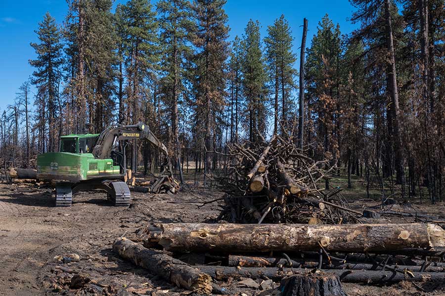
Heavy equipment begins cleanup efforts in a recently burned area in Oregon. Photo by Jeremy Nolan.
Unfortunately, smoke is an unavoidable reality of fire season. Even when there is no immediate fire danger, thick smoke from distant fires can drift hundreds of miles, settling into valleys and mountain basins. Air quality can deteriorate quickly, turning an otherwise beautiful ride into a hazy, lung-burning grind.
Prolonged exposure to heavy smoke is not just unpleasant, it can be harmful to your health, especially during sustained physical exertion. Riders should monitor daily air quality reports, adjust mileage or rest days accordingly, and be prepared to pause travel if conditions become unsafe. Flexibility once again becomes essential, as wind shifts can dramatically change air quality from one day to the next.
Weather
A wide range of weather conditions can be encountered along the entirety of this route. Inclement weather—including severe thunderstorms, flooding, tornadoes, dust storms, snow, and extremely strong winds—is possible. Riders should be prepared for extreme temperatures on both ends of the spectrum, sometimes within the same day. Proper clothing is essential, including versatile layers for warmth, sun protection for exposed stretches, and reliable rain gear.
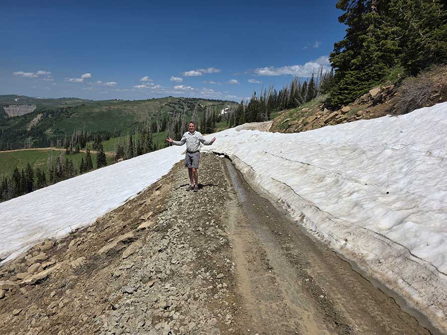
A late season snow drift blocking the route in Utah. Photo by Carl Gable.
Wildlife Encounters
Wildlife encounters are part of the experience across much of this route, and while most animals pose little threat if given space, awareness is essential.
All forested portions of this route are considered black bear country. Always be bear-aware, and follow these rules when camping (these will help ward off other unwanted visitors too, such as raccoons and mice):
- Store all food, garbage, and other attractants in a bear-resistant manner, well away from your tent. This can include hanging them in a stuff sack from rope slung over a high, isolated tree branch, or storing them in a bear-proof container provided at campgrounds.
- Attractants such as food leftovers, fish entrails, and bacon grease should not be buried or burned in campfires. Leftover food and waste should be placed in a sealed bag or container and packed out with garbage. If leftover food or other attractants must be burned, do so in a contained cookstove or in an appropriate container over a campfire, then pack out the ash.
In parts of Colorado, Wyoming, Utah, and Idaho, moose can be more dangerous than bears. They are unpredictable and especially aggressive during rut (fall) and when cows have calves (spring/early summer). Give them a very wide berth.
Other wildlife to be mindful of includes rattlesnakes, ticks, and mosquitos, which are common along many stretches of the route. In drier regions, scorpions may take shelter under shoes or gloves left outside overnight, so check your gear carefully. In some rural areas, feral or aggressive dogs can also pose a risk to cyclists. For guidance on managing encounters with dogs while riding, see advcy.link/dogs.

A rattlesnake on the route in Idaho. Photo by Jeremy Nolan.
Remote Conditions
Much of this route travels through extremely remote terrain, where rescue or assistance may be several hours, or longer, away. Riders should carefully consider the risks of traveling alone. In fact, a minimum group size of three is strongly recommended. If someone becomes injured or seriously ill in the backcountry, one person can remain with the injured/sick rider, while the other goes for help.
Cell phone reception is unreliable or nonexistent along large portions of the route. Riders should not depend on mobile service in an emergency and are strongly encouraged to carry a satellite communication device to summon help if needed.
Route Highlights
Golden Gravel Trail Highlights
- Roger Pryor Pioneer Backcountry, Section 1
- Echo Bluff State Park/Current River, Section 1
- Frisco Highline Trail, Section 1
- Prairie State Park, Section 1
- Mined Land Wildlife Areas, Section 2
- Osage Hills State Park, Section 2
- Joseph H. Williams Tallgrass Prairie Preserve, Section 2
- Salt Plains State Park, Section 2
- Alabaster Caverns State Park, Section 2
- Cimarron National Grassland, Section 3
- John Martin Reservoir State Park, Section 3
- Pueblo, CO Riverwalk and bike paths, Section 3
- Lake Pueblo State Park, Section 3
- Bishop Castle, Section 3
- Westcliffe, CO, Section 3
- Salida, CO, Section 3
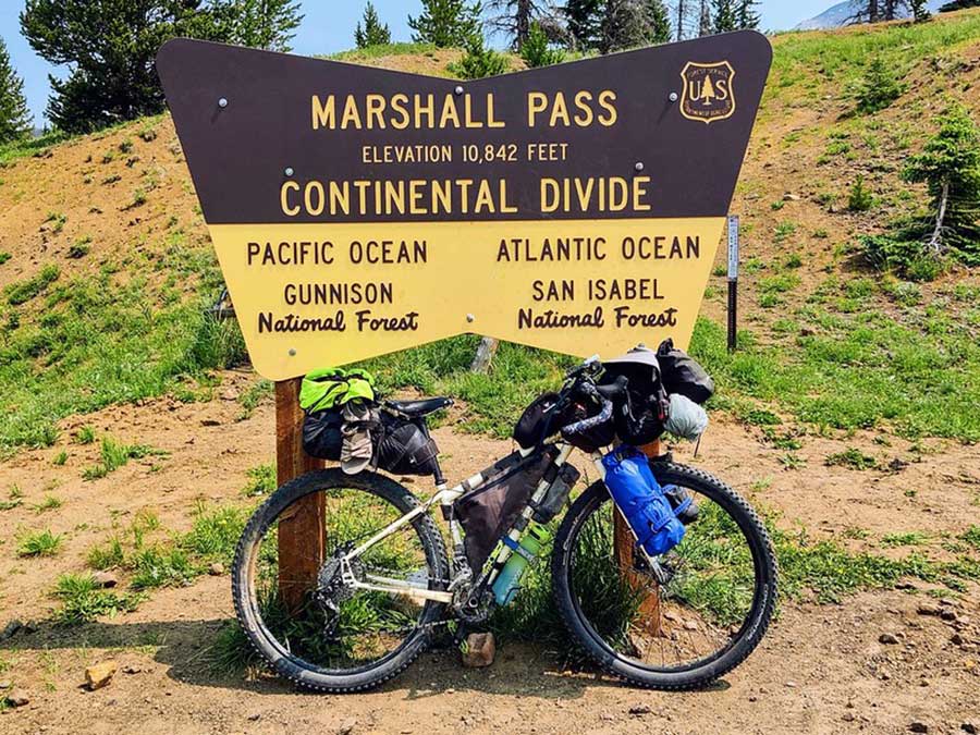
- Continental Divide at Marshall Pass, Section 3
- Route’s highest point at Cumberland Pass, Section 3
- Crested Butte, CO, Section 3
- Paonia, CO, Section 3
- Moab, CO, Sections 3 & 4
- Moab Canyon Pathway, Section 4
- Gemini Bridges, Section 4
- San Rafael Swell (Black Dragon Canyon and Buckhorn Wash), Section 4
- Skyline Drive, Section 4
- Strawberry Reservoir, Section 4
- Park City, UT, Section 4
- Historic Union Pacific Rail Trail, Section 4
- Bear Lake, Section 4
- Lava Hot Springs, Section 5
- Chesterfield Ghost Town, Section 5
- Craters of the Moon area, Section 5
- Ketchum, ID, Section 5
- Multiple hot springs in Idaho, Section 5
- Idaho City, Section 5
- Prairie City, OR (Prairie City Alternate), Section 6
- Mitchell, OR, Section 6
- Lower Crooked River Backcountry Byway, Section 6
- Newberry National Volcanic Monument, Section 6
- Multiple waterfalls and swimming holes in Oregon, Section 6
- Port Orford, OR, Section 6
More Route Resources
- How to Be Bear Aware When Bike Camping
- How to Travel with Your Bike on Amtrak
- International Mountain Bicycling Association (IMBA) Rules of the Trail
- USDA Forest Service Maps
- Dispersed Camping Guidelines USFS
- Dispersed Camping Guidelines BLM
- How to Stop a Charging Dog
- Safety Concerns for Bikepackers
- Practical Advice for Riding The Golden Gravel Trail
- How Much Water Should You Carry for Bikepacking?
- National Interagency Fire Center
- Connect and share photos with other riders on Instagram: #acaGGT
RIDING CONDITIONS
Section 1 of the Golden Gravel Trail begins on the banks of the Mississippi River in Cape Girardeau, Missouri. Riders can ceremoniously dip their tires in the water of the mighty river while taking in the colorful murals along the town’s “Great Wall”, completed in 1964 to protect the city from flooding. After a short ride through the town’s historic downtown, the route winds past the stately halls of Southeast Missouri State University and through shady neighborhood streets. Leaving the outskirts of Cape Girardeau behind, the trail transitions onto quiet paved and gravel country roads that weave through open farmland.
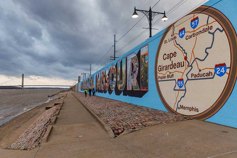
Cape Girardeau’s flood wall at the Golden Gravel Trail’s eastern terminus on the Mississippi River. CC Image courtesy of Fred Ortlip on Flickr.
Leaving the Mississippi River Valley, the trail settles into a steady rhythm across the gently rolling Ozark Mountains of southern Missouri, alternating between gravel and paved roads. The route passes through a mix of shady forests, open farmland, and small towns conveniently spaced for food and water resupply. Gravel roads in this region are generally well-maintained, though surfaces become rocky, loose, and uneven as roads descend into low spots and stream crossings. Paved secondary state roads in Missouri (designated with letters) are hilly, curvy, and have no shoulders, but carry very little traffic.
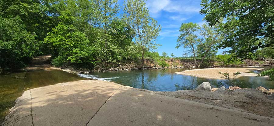
Many backroads in Missouri feature low-water crossings that can flood and become impassable during heavy rain or after isolated storms, particularly in the Ozark Mountains, which are highly susceptible to flash flooding. Never attempt to cross a flooded roadway if the water is moving swiftly or appears deeper than a few inches. When in doubt, find an alternate route or wait for water levels to drop, usually within a few hours. Some crossings have a constant trickle of water even in dry conditions, so prepare to get your toes, or tires, a bit wet along the way. Avoid camping near creeks, rivers, or in low-lying areas where water levels can rise quickly, and activate weather alerts on your electronic devices to receive timely notifications for flash flood watches and warnings. Most, though not all, low-water crossings are marked on the map to help plan during wet conditions.
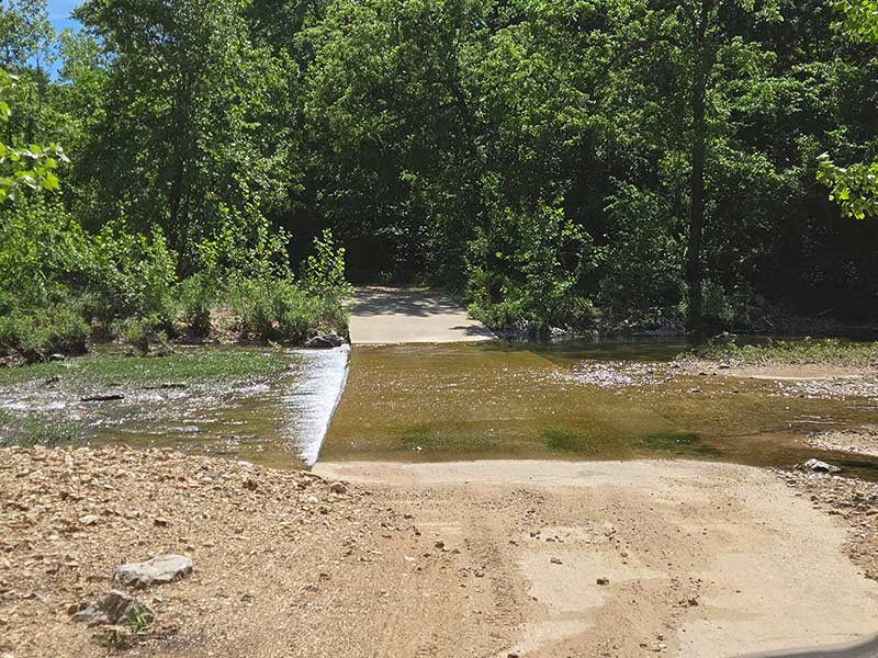
One of the many low-water crossings along the route in Missouri. Photo by John Hormell.
There are limited services on the route for 99 miles (159 km) between Annapolis and Summersville. Some basic resupply can be found off route in Lesterville and Centerville if needed, and there is a restaurant and small mercantile with food staples, snacks, and drinks at the Echo Bluff State Park Lodge.
A few miles west of Annapolis, the crystal-clear waters of the Black River serve as a hub for outdoor recreation ideal for rafting, kayaking, and floating. Several campgrounds and lodges line the riverbanks, making this a peaceful and scenic spot for an overnight stay. Stay alert for rafting traffic and shuttles on Annapolis Road. For resupply in the area, Lesterville is just a few miles off route to the north.
The Roger Pryor Pioneer Backcountry offers wilderness solitude and demonstrates the positive results of sustainable forest management in one of the most undeveloped areas of the Missouri Ozarks. The route passes through dense forest where the canopy provides ample shade and the surroundings grow noticeably quieter and more remote. Depending on the season and weather, be prepared to get your toes wet at the crossing of Big Creek. Dispersed primitive camping is allowed within the Backcountry.
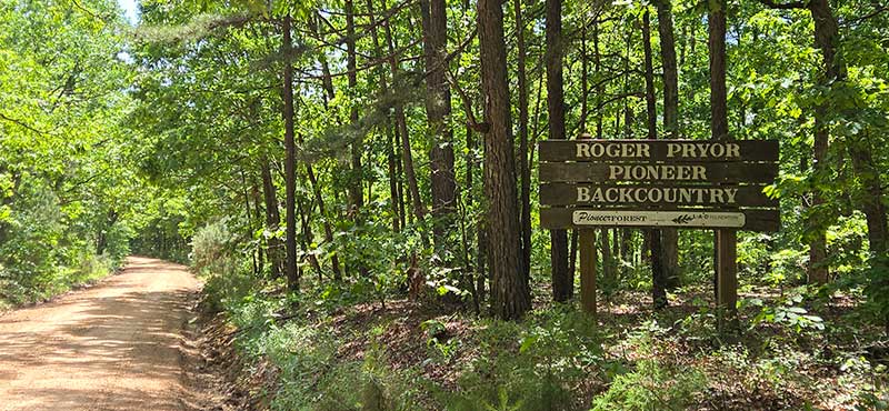
The Roger Pryor Pioneer Backcountry. Photo by John Hormell.
The Current River attracts visitors from across the country with its crystal-clear waters, towering cliffs, turquoise springs, and remarkable formations in Round Spring Cave. In 1971, the river became part of the Ozark National Scenic Riverways, the nation’s first national park area established to protect a river system. Nearby Echo Bluff State Park offers camping, lodging, hiking, canoeing, and swimming opportunities, making it an ideal spot to rest and explore the natural beauty of the Ozarks.
Tourists and traffic fade away upon entering the Sunklands Conservation Area, a landscape characterized by large sinkholes and wetlands important to native animal and plant species. The roads through this section are primarily well-maintained doubletrack, offering a quiet ride beneath the trees. Dispersed primitive camping is allowed within the Conservation Area.
The route emerges from the forest at Summersville, the first town on the route since Annapolis. From here, the landscape opens into a mix of rolling farmland and scattered woodlots. The terrain gradually flattens and small towns appear at regular intervals every 20-50 miles (30-80 km).
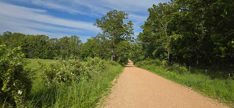
The Golden Gravel Trail near Summersville. Photo by John Hormell.
The route follows the Frisco Highline Trail for 14 miles (22.5 km) near Walnut Grove. The tree-lined doubletrack trail is well-maintained and includes several bridges and interpretive kiosks that share the history of the former railroad line.
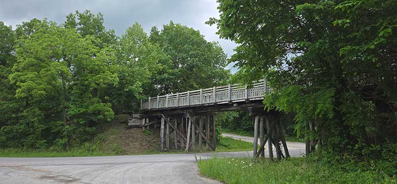
A bridge on the Frisco Highline Trail. Photo by John Hormell.
From the Frisco Highline Trail to Pittsburg, Kansas, the landscape opens into broad expanses of corn and wheat fields occasionally interrupted by scattered woodland. The roads straighten and the terrain flattens, creating long, uninterrupted views in every direction. Though still in Missouri, the scenery begins to resemble Kansas as trees give way to open farmland, and with little shade, the heat can feel more intense.
Lamar, the birthplace of 33rd U.S. President Harry S. Truman, offers a final opportunity to spend the night and resupply before reaching the section end in Pittsburg. The route passes directly by Truman’s childhood home, now preserved as a state historic site with guided tours.
West of Lamar, the route enters Prairie State Park, which preserves one of the last remaining tracts of native tallgrass prairie in Missouri. The park features a small campground, hiking trails, a nature center, and even small herds of elk and bison. These wild bison roam freely throughout the Park and can be extremely dangerous if approached. Riders should remain on designated public roads and never approach, harass, or attempt to interact with the animals. If bison are blocking the road, wait at a safe distance until they move away on their own. Do not attempt to shoo them off the road under any circumstances.
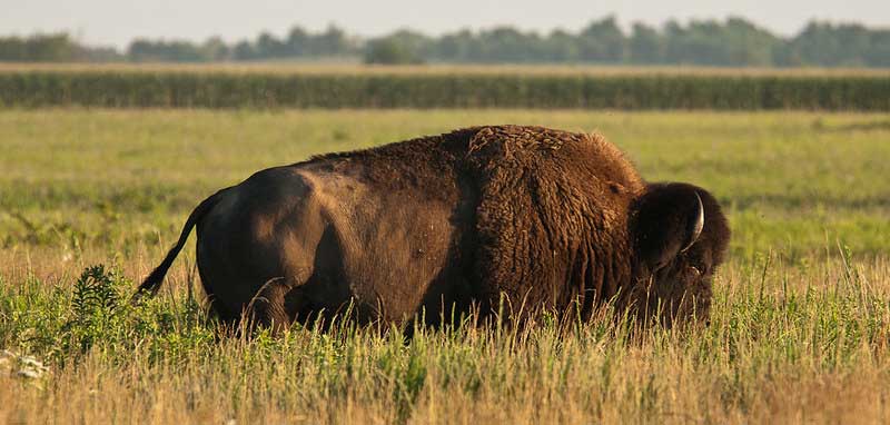
Bison grazing at Prairie State Park. CC Image courtesy of mostateparks on Flickr.
Near the small town of Mindenmines, the route enters a landscape scarred by extensive surface coal mining that occurred between the 1920s and 1974. The route follows this patchwork of strip-mine lakes, wetlands, and recovering forests of oak, walnut, and hickory, which stretches southwest in a narrow band all the way to Oswego, Kansas, in Section 2. After crossing into Kansas near Pittsburg, these mined areas are managed by the Kansas Department of Wildlife and Parks, where primitive camping is allowed in the mowed areas or near boat ramps. Note that swimming in the lakes is not permitted.
Between Cape Girardeau and Pittsburg, the Golden Gravel Trail intersects with another iconic Adventure Cycling route: the TransAmerica Trail. The two routes crisscross several times, dipping into many of the same small towns for resupply. These shared stops provide the opportunity to commune, or commiserate, with other riders over the joys and hardships of life on two wheels.
Hotels are scarce in some of the smaller towns of western Missouri. For indoor accommodations, riders may need to rely on private lodging options such as Airbnb. Developed campgrounds are also uncommon, so several nights will be spent in city parks and other non-traditional camping areas. City parks that permit overnight camping are marked on the map, and it is recommended to call city hall or the local sheriff to inform them of your presence.
Pittsburg, Kansas is the largest town on the route yet and offers a full range of services, making it an excellent place to rest, recharge, and resupply before leaving the Ozarks behind and entering the vast, rolling fields of the Great Plains in Section 2 of the Golden Gravel Trail.
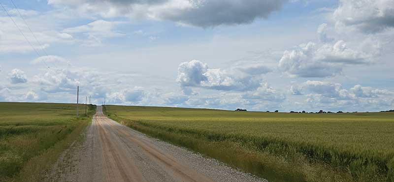
Rolling wheat fields under vast blue skies near Pittsburg, Kansas. Photo by John Hormell.
CLIMATE
The route from Cape Girardeau, Missouri, to Pittsburg, Kansas, travels through a humid subtropical climate zone, with weather strongly influenced by warm, moist air from the Gulf of Mexico. Overall, riders can expect stormy and wet conditions in spring, hot and humid summers, and cool, generally pleasant autumns.
Thunderstorms are common in spring and summer and may bring heavy rain, lightning, hail, and sudden gust fronts. A greenish tint to the sky often indicates large hail and is a sign that immediate cover should be sought.
This region also lies within Tornado Alley, with the highest tornado risk from April through June, particularly in the flatter Mississippi River lowlands and open plains approaching Kansas. While tornadoes are relatively rare, severe storms are usually forecasted, and riders should monitor weather conditions closely and be prepared to seek shelter in substantial buildings if tornados are imminent. If no shelter is available, move to a low-lying area such as a ditch, lie flat, and protect your head and neck with your arms.
Much of this route is prone to flash flooding, especially in spring and early summer and during periods of prolonged or intense rainfall. The risk is highest in the Ozark Highlands, where steep terrain, thin soils, and rocky creek beds cause water levels to rise rapidly after storms. Roads that are dry one hour can become impassable the next. Do not attempt to cross flooded roads or river crossings and plan daily mileage with the possibility of delays if the weather has been especially wet. Even outside the Ozarks, flash flooding can occur in low-lying farmland and as the route approaches Kansas.
Summer is hot and humid throughout Missouri, with the most oppressive conditions often felt at lower elevations near Cape Girardeau and westward into Kansas. Daytime highs commonly reach the upper 80s to mid-90s °F, with warm nights and frequent afternoon thunderstorms. Heat management is essential; shade is limited outside the forested Ozark stretches, and riding early in the day is often the best strategy to avoid peak temperatures.
REMOTE RIDING CONDITIONS
Many wild, remote stretches exist along this route, particularly in the Ozark Mountains. High temperatures, inclement weather (including severe thunderstorms, tornadoes, flash flooding, and strong winds), and other potential hazards are possible. Understand in advance how to prepare for and cope with them.
Towns and established campgrounds with potable water are regularly spaced along the route, so water resupply is generally straightforward. Riders should still fill up whenever the opportunity presents itself and plan ahead for a few longer stretches between reliable sources.
Pack along bug repellent, sunscreen, and a first-aid kit. Bike shops are only found in Cape Girardeau and Pittsburg (as of 2026), so be prepared for any mechanical possibility. At minimum, carry bicycle tools, a tire pump, and spare tubes, even if riding tubeless.
Most of this route is in black bear country. Always be bear-aware, and follow these rules when camping (these will help ward off other unwanted visitors too, such as raccoons and mice):
- Store all food, garbage, and other attractants in a bear-resistant manner, well away from your tent. This can include hanging them in a stuff sack from rope slung over a high, isolated tree branch, or storing them in a bear-proof container provided at campgrounds.
- Attractants such as food leftovers, fish entrails, and bacon grease should not be buried or burned in campfires. Leftover food and waste should be placed in a sealed bag or container and packed out with garbage. If leftover food or other attractants must be burned, do so in a contained cookstove or in an appropriate container over a campfire, then pack out the ash.
We discourage you from attempting to ride this route solo; in fact, a minimum group size of three is strongly recommended. If a rider is debilitated in the backcountry, you will want to have at least one person to stay with the injured/sick rider, and another to go for help. Be aware that cell phone reception is very spotty along much of the route, and it is recommended to carry a satellite phone in case of emergency.
LAND ACKNOWLEDGEMENT
As we travel by bicycle through these lands, we pause to reflect on our relationship with this place. We ride with respect and honor for the Indigenous peoples who have stewarded these mountains, forests, and waters since time immemorial. We commit to caring for this land by staying on paths, leaving no trace, and listening to the wisdom of the Indigenous peoples, including the Osage, Quapaw, Kickapoo, and others who call these territories home. May your journey be guided by respect, gratitude, and responsibility.
ACKNOWLEDGEMENTS
Special thanks to John Hormell, and his partner Denny Koontz, for scouting this route during the spring of 2025. John’s notes, insights, and recommendations were invaluable in the creation of this section of the Golden Gravel Trail.
RIDING CONDITIONS
Section 2 of the Golden Gravel Trail begins in Pittsburg, Kansas which is the largest town on the route for several hundred miles in either direction. Leaving Pittsburg, the route winds through a patchwork landscape scarred by decades of surface coal mining between the 1920s and 1974. Now managed by the Kansas Department of Wildlife and Parks, the Mined Land Wildlife Area stands as a successful example of habitat restoration on lands once subjected to unmitigated environmental damage. Near the small community of West Mineral, a massive electric shovel known as “Big Brutus” remains on display as a monument to the region’s mining history. More than 1,000 strip-mine lakes are scattered across the area, now surrounded by wetlands, native grassland, and recovering forests of oak, walnut, and hickory. These restored habitats support a variety of wildlife, including raccoons, muskrats, bobcats, fox, turkey, deer, and coyotes. Primitive camping is allowed throughout the Mined Land Wildlife Area in the mowed areas or near the boat ramps and many sites close to the route are marked on the map. Note that swimming in the lakes is not permitted.
A quiet evening in the Mined Land Wildlife Area. Photo by John Hormell.
The remainder of Kansas is characterized by long, straight gravel roads threading through scattered trees and broad fields of corn and wheat. The small towns of Oswego and Chetopa provide opportunities to resupply and spend the night close to civilization. Northwest Hallowell Road along the Neosho River near Oswego may be impassable during high water events. US Highway 160 can be used as a detour if needed. Upon entering Oklahoma, the route passes into the Cherokee Nation, whose people were forcibly relocated to this region along the Trails of Tears in the mid-1800s. The landscape remains largely unchanged as the route continues through peaceful open countryside.
Scattered trees near Chetopa. Photo by John Hormell.
The quiet town of Copan sits near the shores of Copan Lake, a large reservoir with shady lakeside campgrounds managed by the Army Corps of Engineers. West of Copan, the route enters the Osage Reservation and farmland gives way to open prairie, wetlands, and rolling hills dotted with forests and grazing cattle.
Osage Hills State Park lies just three miles (5 km) off route and is a prime example of Oklahoma’s natural beauty. Rocky bluffs rise above lush, forested hills with more than 1,100 acres of scenic terrain that feels worlds away from the surrounding prairie. The park offers plenty of camping, scenic overlooks, and even a swimming pool for visitors to enjoy.
Kansas and eastern Oklahoma feature several low-water crossings that can flood and become impassable during heavy rain or after isolated storms. Never attempt to cross a flooded roadway if the water is moving swiftly or appears deeper than a few inches. When in doubt, find an alternate route or wait for water levels to drop. Some crossings have a constant trickle even during dry conditions, so prepare to get your toes, or tires, a bit wet along the way. Most, though not all, low-water crossings are marked on the map so you can plan accordingly during wet conditions.
Pawhuska is a city deeply rooted in American Indian culture and Western heritage. Established in 1872, its history is closely intertwined with that of the Osage Nation, which is headquartered in the town. Pawhuska was central to the 1920s Osage oil boom, and the immense wealth generated during that era is still reflected in the ornate architecture and historic buildings that define its downtown.
North of Pawhuska, the route enters the Joseph H. Williams Tallgrass Prairie Preserve, home to the largest remaining tract of tallgrass prairie in the world. Its main attraction is a herd of over 2,500 bison, which grazed these lands for millennia before the introduction of cattle by European settlers. These wild bison roam freely throughout the Preserve and can be extremely dangerous if approached. Riders should remain on designated public roads and never approach, harass, or attempt to interact with the animals. If bison are blocking the road, wait at a safe distance until they move away on their own. Do not attempt to shoo them off the road under any circumstances. Camping is strictly prohibited anywhere within the Preserve.
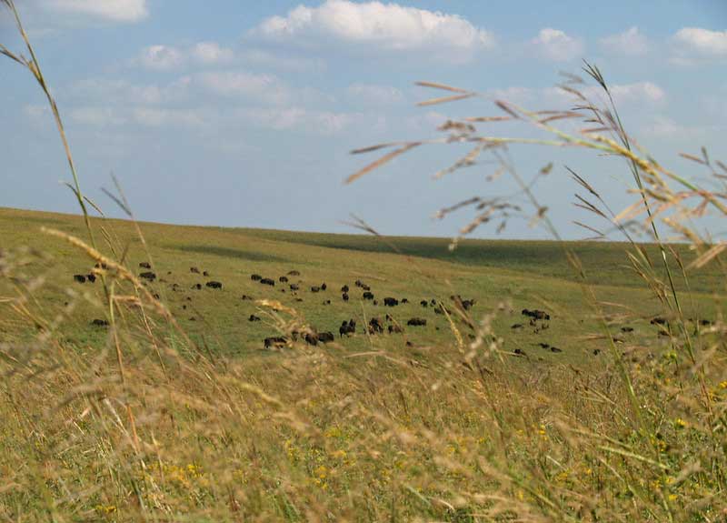
Bison roam wild on the Tallgrass Prairie Preserve. CC Image courtesy of “by and by” on Flickr.
The route enters land belonging to the Kaw Nation as it descends into the Arkansas River Valley. The low-lying areas near the Arkansas River and Kaw Lake can flood during high water, causing the route to be impassable, but nearby roads can be used to get around the closures. Primitive camping is allowed at designated sites within Kaw Wildlife Management Area and is marked on the map. Visit GoOutdoorsOklahoma.com for regulations and more information.
The 100-mile (161 km) stretch between Newkirk and Cherokee is dominated by long, straight gravel roads weaving past agricultural land, wind farms, pumpjacks, and grazing cattle. The nearby towns of Blackwell and Medford lie just off route and offer additional options for resupply and accommodations. Salt Plains State Park is a statewide destination for camping and recreation in one of Oklahoma’s most distinctive landscapes. The barren terrain of the adjacent Salt Plains National Wildlife Refuge is comprised of salt leftover from an ocean that covered Oklahoma in prehistoric times, and the saltwater lake in the park, Great Salt Plains Lake, is about half as salty as the ocean.
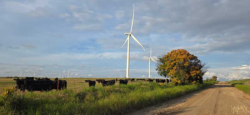
Cows and wind turbines; a common sight along this portion of the route. Photo by John Hormell.
The red dirt roads of central and western Oklahoma are made up of soft, fine clay that becomes sticky when wet and can be impassable if fully saturated. After heavy rain, it may be wise to detour onto nearby paved roads until conditions improve.
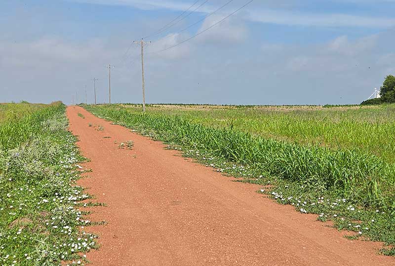
Red dirt roads characteristic of central Oklahoma. Photo by John Hormell.
Alva is an important resupply town offering a full range of services. Be sure to stock up — it is 84 miles (135 km) to the next town of Buffalo, with only limited resupply in the tiny community of Freedom. The route between Alva and Buffalo is remote yet scenic, with gentle hills near the Cimarron River. Alabaster Caverns State Park offers camping and a unique opportunity to join a guided cave tour in one of the world’s largest natural gypsum caves.
The 69-mile (111 km) stretch between Buffalo and Beaver can be broken up by camping at the tiny oasis of Doby Springs Park and Campground, reducing the day’s ride to a more manageable 56 miles (90 km). As of this writing, the small town of Gate has a cafe open for lunch on weekdays, but otherwise no services are available.
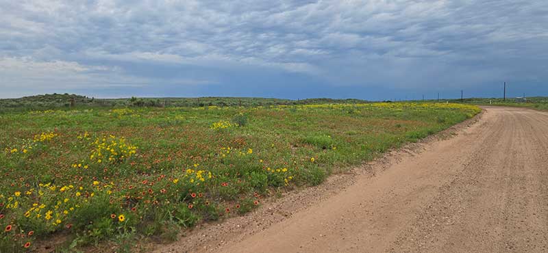
Prairie wildflowers under a stormy June sky. Photo by John Hormell.
The Oklahoma Panhandle, known as the epicenter of the Dust Bowl’s devastation in the 1930s, is the driest part of the state and is noticeably more arid than the rest of the route so far. The land is vast, windswept, and table-flat, with long horizons and little to break the monotony. Unpaved roads in the area are soft, sandy, and dusty, and with limited scenic reward, the route favors quiet paved roads between Beaver and Elkhart to cover ground more efficiently and avoid an otherwise relentless slog. Beaver Dunes Park in Beaver showcases the region’s sandy terrain and offers opportunities for dune buggy riding, hiking, and camping.
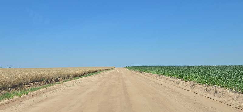
Arid farmland under an endless blue sky. Photo by John Hormell.
With a population of nearly 20,000, the small city of Liberal, Kansas, feels like a welcome reprieve after many miles of riding across the sparsely populated Great Plains. Liberal is home to a sizeable Hispanic population, reflected in the many excellent Mexican restaurants lining its main roads. Fans of the classic film The Wizard of Oz can visit a replica of Dorothy’s house, while aviation enthusiasts can head to the Mid-America Air Museum, home to one of the largest aircraft collections in the country.
The final miles to Elkhart, Kansas, pass through increasingly arid farmland and open prairie as the route pushes deeper into the Rocky Mountain rain shadow. Water is scarce, days are hot and windy, and there are no trees to provide shade from the sun. Though Elkhart is a small town, it offers everything needed to rest and restock before continuing onto Section 3 of the Golden Gravel Trail.
CLIMATE
The route from Pittsburg, Kansas, across northern Oklahoma and back into southwestern Kansas traverses a wide range of Great Plains climates, becoming progressively drier, windier, and more exposed as it gradually climbs west. Eastern Kansas and northeastern Oklahoma tend to be more humid, with warm summers, frequent thunderstorms, and lush spring conditions. As the route continues west, humidity decreases and open prairie dominates, bringing stronger winds, hotter summer temperatures, and fewer opportunities for shade.
Thunderstorms are common in spring and summer and may bring heavy rain, lightning, hail, and sudden gust fronts. A greenish tint to the sky often indicates large hail and is a sign that immediate cover should be sought.
This region also lies within Tornado Alley, with the highest tornado risk from April through June, particularly in eastern Kansas and northeastern Oklahoma. Most towns have sirens to warn of approaching tornado danger. While tornadoes are relatively rare, severe storms are usually forecasted, and riders should monitor weather conditions closely and be prepared to seek shelter in substantial buildings if tornadoes are imminent. If no shelter is available, move to a low-lying area such as a ditch, lie flat, and protect your head and neck with your arms.
West of Alva, through the Oklahoma Panhandle and into southwestern Kansas near Liberal and Elkhart, the climate becomes noticeably more arid due to the Rocky Mountain rain shadow. The route crosses the 100th meridian near Gate, Oklahoma, which is commonly regarded as the dividing line between the semi-arid High Plains to the west and the more humid lowlands to the east. West of this line, average rainfall is just 5-20 inches (13-51 cm); east of it, average annual rainfall jumps to 20-25 inches (51-64 cm). Summer heat can be intense, shade and water are scarce, and strong winds are common. Summer afternoon temperatures regularly exceed 90°F (32°C), and riders may need to begin riding at dawn to avoid the worst heat of the day.
Strong winds combined with dry soils can produce blowing dust, particularly west of Alva through the Oklahoma Panhandle and into southwestern Kansas. Visibility may be reduced during high-wind events, and loose sand and dust can make riding uncomfortable or hazardous, especially near active agricultural areas. Riders should be prepared for eye and respiratory irritation and avoid riding during extreme wind or dust conditions when visibility is poor.
REMOTE RIDING CONDITIONS
Many wild, remote stretches exist along this route. High temperatures, inclement weather (including severe thunderstorms, tornadoes, flooding, dust storms, and extremely strong winds), prairie fires, and other potential hazards are possible. Understand in advance how to prepare for and cope with them.
Piped water sources tend to be limited, so replenish your supplies whenever the opportunity presents itself. Plan to carry enough water between towns or established campgrounds with potable water, and do not rely on creeks, rivers, or lakes as primary water sources. Surface water can be contaminated by agricultural runoff, oil and gas activity, cattle grazing, and heavy mineral content. In the western half of this section, many creeks and rivers run dry during the summer months.
Pack along bug repellent, sunscreen, and a first-aid kit. Bike shops are non-existent across the Great Plains, so be prepared for any mechanical possibility. At minimum, carry bicycle tools, a tire pump, and spare tubes, even if riding tubeless.
We discourage you from attempting to ride this route solo; in fact, a minimum group size of three is strongly recommended. If a rider is debilitated in the backcountry, you will want to have at least one person to stay with the injured/sick rider, and another to go for help. Be aware that cell phone reception is very spotty along much of the route, and it is recommended to carry a satellite phone in case of emergency.
LAND ACKNOWLEDGEMENT
As we travel by bicycle through these lands, we pause to reflect on our relationship with this place. We ride with respect and honor for the Indigenous peoples who have stewarded these grasslands, forests, and waters since time immemorial. We commit to caring for this land by staying on paths, leaving no trace, and listening to the wisdom of the Indigenous peoples. We acknowledge that this route travels through the traditional homelands of the Wichita, Osage, Caddo, Kiowa, Comanche, Apache, and Pawnee peoples, who lived, hunted, and cared for these lands long before European settlement. We also honor the Cherokee Nation, Kickapoo Tribe, Shawnee Tribe, Kaw Nation, and other tribal nations connected to this region today, including those peoples who were forcibly relocated here. May your journey be guided by respect, gratitude, and responsibility.
ACKNOWLEDGEMENTS
Special thanks to John Hormell, and his partner Denny Koontz, for scouting this route during the spring of 2025. John’s notes, insights, and recommendations were invaluable in the creation of this section of the Golden Gravel Trail.
RIDING CONDITIONS
Section 3 of the Golden Gravel Trail begins in the small town of Elkhart, in the extreme southwestern corner of Kansas. Lodging is available in town, but just a few miles to the north lies the Cimarron National Grassland, where camping among tall cottonwood trees, sagebrush, and shortgrass prairie is well worth the four-mile (6 km) detour off the route. Between 1821 and 1846, the Santa Fe Trail traveled through this region as a major trade and travel corridor linking Old Franklin, Missouri with Santa Fe, New Mexico. Today, the Cimarron National Grassland preserves 23 miles (37 km) of this historic trail with markers and interpretive signs detailing its role in westward trade and travel.
The route crosses into the Mountain Time Zone at the Colorado state line. Westbound riders should set their watches back one hour; eastbound riders move them ahead one hour.
Cottonwood trees by the pond at Cimarron Campground in Cimarron National Grassland. Photo by Carl Gable.
It is 73 miles (117 km) between Elkhart and Springfield, Colorado, though camping at Cimarron Campground slightly reduces this distance. Riders should carry ample water and food, as there are no services along the way. The landscape is vast, windswept, and table-flat, with long horizons and little to break the monotony. Unpaved roads in this area are often soft, sandy, and dusty, which can slow travel. While efforts have been made to avoid the worst conditions, riders should expect very soft shoulders and roads that may become impassable if fully saturated. Potential water sources in the form of cattle troughs are marked on the map, but they may be dry and should never be fully relied upon. A farmhouse may be able to help in an emergency. At the crossing of Sand Arroyo Creek, the route passes through a unit of the Comanche National Grassland where dispersed camping is permitted, though no reliable water source is available nearby.
Comanche National Grassland between Elkhart and Springfield. Photo by Nat Cobb.
Springfield is an important resupply town, situated in one of the least populated regions of Colorado. Southeastern Colorado was devastated by the Dust Bowl of the 1930s, and even today the resilient communities and landscape continue to recover from the extreme wind erosion that occurred during that time.
Abandoned homesteads serve as a reminder of the Dust Bowl that devastated the region in the 1930s. Photo by Nat Cobb.
The 64 miles (103 km) between Springfield and Hasty Campground at John Martin Reservoir State Park are vast, dry, and desolate. Farmland gradually gives way to open rangeland, and riders are likely to encounter more pronghorns and cattle than humans. Potential water sources in the form of cattle troughs are marked on the map, but they may be dry and should never be fully relied upon.
Sometimes called “a sapphire on the plains,” John Martin Reservoir State Park offers a welcome reprieve with showers, laundry, and shaded, grassy campsites. For the next 130 miles (209 km), the route generally follows the Lower Arkansas River Valley on low-traffic roads, alternating between farmland and open prairie as it heads toward Pueblo at the base of the Rocky Mountain Front Range.
US Highway 50 is used briefly to enter Las Animas, and while the shoulders are wide, traffic is fast and moderately heavy. Use extra caution on the bridge over the Arkansas River where the shoulders narrow.
La Junta offers full services and serves as a railroad hub for both freight and passenger trains. Its name comes from the Spanish word for “junction”, originally referring to the intersection of the Santa Fe Trail and a pioneer road leading to Pueblo. Rocky Ford, located just off route, offers additional services and is famous across the region for its exceptionally sweet melons, thanks to the area’s unique soil and dramatic day-night temperature swings.
Between Fowler and Pueblo, the route dips south to follow gravel roads along a remote stretch of the Huerfano River. The river often runs dry, but cottonwood groves and marshes along its bed provide pleasant scenery. Just before entering Pueblo, riders will pass the Sun Mountain and Bighorn Solar Farms, two massive solar energy projects sprawling across more than 3,000 acres of prairie.
Gravel roads along the Huerfano River between Fowler and Pueblo. Photo by Nat Cobb.
Pueblo is the largest town on the entire route and a vital stop for rest, resupply, and any mechanical needs before entering the rugged Rocky Mountains. Once a thriving center of the steel industry, the city has re-invented itself as a hub for green energy, recreation, and the arts. The route follows bike paths along Phelps Creek and the Arkansas River to enter and exit the lively downtown area, providing a pleasant traffic-free experience despite the increased population. Just west of town, Arkansas Point Campground at Lake Pueblo State Park sits adjacent to 63 miles (101 km) of mountain bike trails to explore, perfect for riders looking to sample some of the local singletrack. The campground can get busy, so reservations are recommended, especially on summer weekends.
West of Pueblo, the character of the route changes dramatically as the High Plains transition into the Rocky Mountains. The climb begins gradually through scattered forests of piñon pine and juniper, leading to the small community of Beulah nestled in the eastern foothills of the Wet Mountains. Beulah offers basic services and provides an opportunity to rest or grab a bite to eat before the climbing begins in earnest. West of Beulah, the route steepens significantly as it rises through aspen and coniferous forest.
Several campgrounds are available along Colorado Highway 165, along with opportunities for dispersed camping within San Isabel National Forest. The roadside attraction of Bishop Castle lies directly on the route and is well worth a stop. This intricate, one-man project features elaborate medieval-fantasy construction and offers free, self-guided tours year-round.
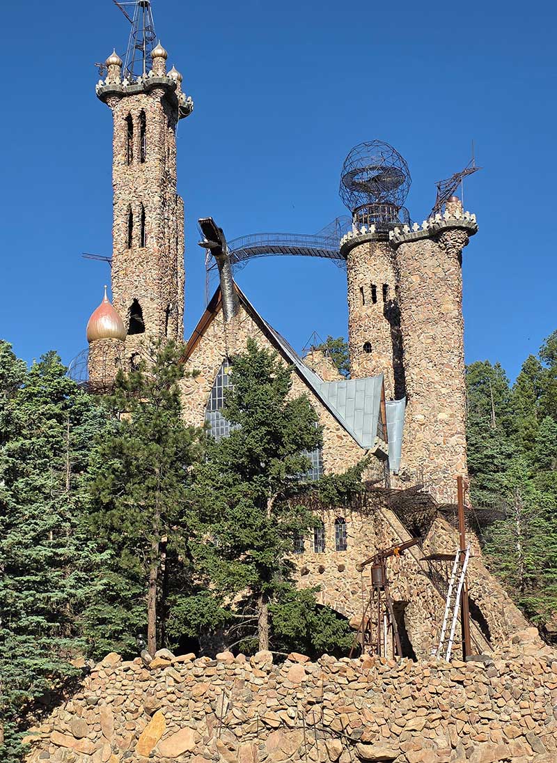
The roadside attraction of Bishop Castle. Photo by Carl Gable.
The route descends into the Wet Mountain Valley and zigzags along farm and ranch roads to avoid high-speed traffic on Colorado Highway 69. To the west, the Sangre de Cristo Range dominates the horizon, with peaks rising above 14,000 feet (4,267m). Once a small railroad hub, Westcliffe has since transitioned into a tourist destination for stargazers. In 2015, the sister towns of Westcliffe and Silver Cliff were designated as an International Dark Sky Community, recognizing the Wet Mountain Valley’s commitment to reducing light pollution.
Near the summit of the Wet Mountains. Photo by Carl Gable.
Between Westcliffe and Cotopaxi, the route is forced onto Colorado Highway 69 for a few short sections. The highway has no shoulders and carries fast, potentially heavy traffic, with rolling hills that can obscure sightlines. Use extreme caution when riding these segments.
The route crosses the Arkansas River again at Cotopaxi, a small outpost that draws thousands of whitewater rafters each year. Be sure to stock up at the store (closed on Sundays) as it is another 45 miles (72 km) with no services before reaching Salida. Surface water is scarce in this drier stretch of the mountains, though two spring-fed cattle troughs are marked on the map as potential water sources. Dispersed camping is available within the San Isabel National Forest and on adjacent BLM land.
Gravel roads and grand vistas north of Cotopaxi. Photo by Nat Cobb.
North of Cotopaxi, the route runs concurrent with Adventure Cycling’s Great Divide Mountain Bike Route for 58 miles (93 km) to the small town of Sargents. This iconic route follows the spine of the North America’s Continental Divide, stretching 3,097 miles (4,984 km) from Jasper, British Columbia to Antelope Wells, New Mexico. Riders can expect an increase in bikepacking traffic along this segment, as several thousand cyclists ride the Great Divide every year.
Salida is a high-elevation mountain town that has become a destination for outdoor recreation, including mountain biking, whitewater rafting, and hiking. Its vibrant downtown is worth a visit, offering multiple bike shops, art galleries, restaurants, and a scenic riverwalk featuring man-made rapids.
South of Poncha Springs, the route follows six miles (10 km) of US Highway 285. Traffic can be heavy and fast, but wide shoulders provide some separation from vehicles. Westbound riders will be traveling uphill, so travel will be slow. Extra caution is advised, especially on weekends.
The climb into the Sawatch Mountains over the Continental Divide at Marshall Pass (10,842 ft./3,305m) follows the path of an old narrow gauge railroad line built in 1881. Thanks to this alignment, grades never exceed 4%, despite the significant elevation gain. Dispersed camping is plentiful, except near O’Haver Lake Campground, which can be very busy on weekends. Surface water can be found in several small creeks on either side of the pass.
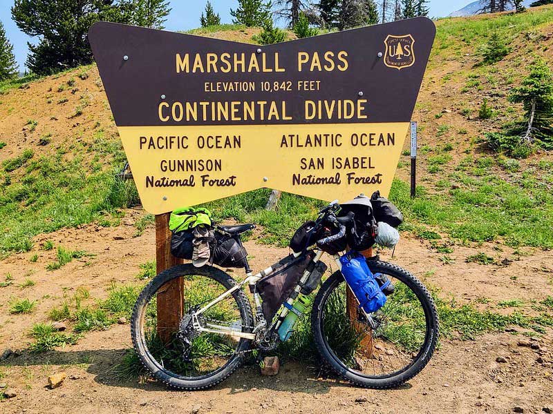
Crossing the Continental Divide at Marshall Pass. CC Image courtesy of exploringwild.com.
The small community of Sargents offers a chance for basic resupply before tackling the two short climbs over Black Sage Pass (9,722 ft./2,963m) and Waunita Pass (10,311 ft./3,142m). Use caution on the 1.2-mile (1.9 km) stretch of US Highway 50 just north of town, where paved shoulders are narrow and traffic can be fast and heavy. A narrow dirt shoulder provides a few extra inches of riding room, though it may be soft. The route through the Tomichi Creek Valley and Waunita Park showcases the quintessential scenery of Colorado’s high-elevation valleys and parks. Good dispersed camping is available at the top of Black Sage Pass, though no water is available nearby.
Descending into Waunita Park from Black Sage Pass. Photo by Nat Cobb.
The historic mining town of Pitkin serves as a staging ground for one of the most challenging climbs of the route. The ascent over Cumberland Pass (12,034 ft./3,668m) is the highest pass on the entire Golden Gravel Trail, and the combination of extreme altitude, sustained climbing, and rocky road surfaces means that even very fit riders may spend time pushing their bikes. Take time in Pitkin to rest, resupply, and prepare both mentally and physically for the effort ahead. Despite the impressive altitude, the grade of the road is not exceedingly steep. It was initially designed as a wagon road to transport metal ore between the mining towns of Pitkin and Tincup, and evidence of this mining history can still be seen along the switchbacks. Cumberland Pass is also popular with off-road vehicles, so be prepared to share the road. In heavy snow years, the pass may not open to vehicles until mid-June, though determined cyclists can often push their bikes across short snowdrifts that stop jeeps and ATVs. In Tincup, riders can reward themselves with a well-earned slice of pie at Frenchy’s Cafe.
The climb over Cumberland Pass. Photo by Nat Cobb.
Just beyond Tincup, the route enters scenic Taylor Park, with Taylor Park Reservoir as its sparkling centerpiece. Camping is plentiful in the area, and the Taylor Park Trading Post offers basic groceries. This area is popular with off-roaders, so expect an increase in motorized traffic and dusty road conditions. After summiting an unnamed pass, the route descends to the Taylor River where several forest service campgrounds offer riverfront camping.
A cattle guard crossing between Taylor Park and Crested Butte. Photo by John Hormell.
The route follows ten miles (16 km) of Colorado Highway 135 to reach the iconic ski town of Crested Butte before diverting onto the Deli Trail Recreational Path for the final approach. The highway has wide shoulders, but it carries a high level of local and recreational traffic. Crested Butte is a scenic mountain town popular with tourists, and as a result, overnight accommodations are expensive. Both dispersed and designated camping are not available near town, so plan accordingly.
The road over Kebler Pass (10,007 ft./3050m) through Gunnison National Forest is highly scenic, with abundant camping opportunities and several creeks suitable for filtering water. The gravel surface is well-maintained, with a few miles of pavement straddling the summit. Despite being mostly unpaved, Kebler Pass Road serves as the primary seasonal traffic route between Crested Butte and Paonia/Delta, so traffic, including trucks, is heavier than might be expected.
Marcellina Mountain towers over the route near Kebler Pass. Photo by Nat Cobb.
The long descent from Kebler Pass continues onto Colorado Highway 133 along the North Fork Gunnison River. Just below the dam, Anthracite Campground at Paonia State Park offers riverfront camping. The highway meanders through the canyon past two active coal mines with moderately wide shoulders, though Bowie Road provides a four-mile (6 km) break from riding with highway traffic. Use caution at the three diagonal railroad crossings along Bowie Road. For the final 1.7 miles (2.7 km) of highway before the turnoff to Paonia, the shoulders disappear entirely, so ride with extreme caution.
Anthracite Creek near Erickson Springs Campground. Photo by John Hormell.
As the route descends toward Paonia, riders will notice a distinct shift in the surrounding landscape. Coniferous and aspen forests give way to a drier climate, and wineries, orchards, and small farms spread across the valley floor. Paonia is known for its rural charm, thriving art scene, and strong emphasis on organic farming practices. Between Paonia and Orchard City, the route travels on paved farm roads past many vineyards and fruit orchards growing cherries, apricots, peaches, plums, pears, and nectarines. South of Orchard City, the route enters the Adobe Badlands, a stark, barren, moonlike landscape at the base of Grand Mesa.
Delta is an important resupply town situated at the confluence of the Gunnison and Uncompahgre Rivers. Be sure to stock up on food—the next full-service town is 165 miles (265 km) away at Moab, with only the small town of Nucla in between.
The high desert landscape near Delta. Photo by Carl Gable.
The gravel climb up the Uncompahgre Plateau is long, steady, and dry. As elevation increases, the forest returns, though surface water remains scarce. A piped spring near Columbine Campground provides the best water in the area. Dispersed camping is available within Uncompahgre National Forest and on adjacent BLM land. The western slope of the plateau has more water sources, though they may be seasonal.
Despite being mostly unpaved, this well-maintained road serves as a significant shortcut for vehicle traffic between Delta and Nucla. Traffic is generally very light but may be higher than expected for such a remote gravel road. After summiting Columbine Pass (9,155 ft./2,790m), the route drops into a spectacular descent toward Nucla, with sweeping views of the canyons and mesas below.
The route near Columbine Pass atop the Uncompahgre Plateau. Photo by Nat Cobb.
Nucla is a small town founded in 1915 with the intention of serving as the “nucleus” for social and business activity in the valley. Today, the town’s fortunes rise and fall with the success of nearby uranium mines. Nucla has limited services, but additional options, including a bike shop (as of 2026), are available four miles (6 km) off route in the town of Naturita.
Between Nucla and Paradox, the route provides a taste of the American Southwest’s famous red rock country, featuring striking sandstone formations, deeply carved river canyons, and flat-topped tablelands. Vegetation is sparse, and with little protection from the sun, days can be brutally hot. A solar-powered well north of Nucla is marked on the map, and water can be filtered from the San Miguel and Dolores Rivers. River water in the region is often silty, so to protect your filter, allow sediment to settle first or pre-filter through a bandana or coffee filter.
The road between Nucla and the San Miguel River can be rough and occasionally fades to doubletrack. The short descent to Tabeguache Creek at its confluence with the San Miguel River is steep and particularly rough, so ride with caution or consider walking your bike. The La Sal Mountains rise prominently on the far western horizon, providing a striking preview of the challenging terrain yet to come.
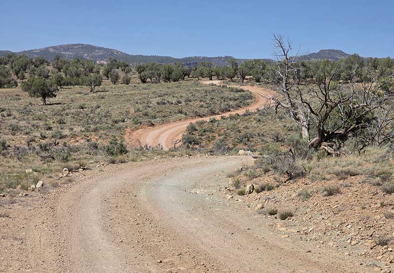
The route between Nucla and the San Miguel River. Photo by Carl Gable.
The carved river canyons of the San Miguel and Dolores Rivers provide stunning scenery along this portion of the route. In 1887, the Montrose Placer Mining Company purchased mining claims and built a wooden flume to transport water from the San Miguel River for hydraulic mining of placer gold deposits. Clinging to the canyon cliffs, the “hanging flume” was an engineering marvel of its time, and remnants of its supports can still be seen attached to the canyon walls. Dispersed camping is possible on BLM land through the Dolores River canyon.
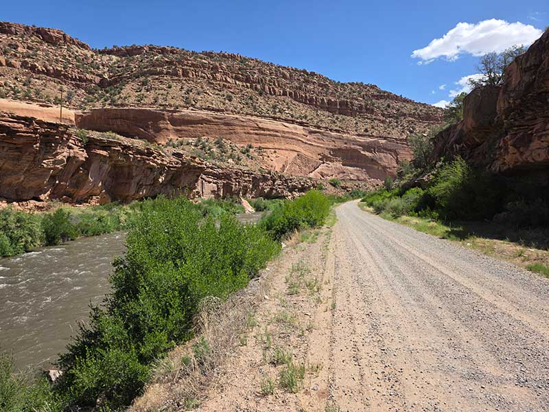
Stunning scenery along the San Miguel River. Photo by Carl Gable.
The 2.4-mile (3.9 km) stretch of Colorado Highway 90 has no shoulders, but traffic is generally light and sightlines are long. Bedrock offers no services, though the small general store is currently for sale (in 2026) and may reopen in the future. Bedrock Campground is just off route and provides riverside campsites with shade structures.
To the north, the tiny hamlet of Paradox also offers no services, though water may be obtained from a private residence or the church with permission. Like Nucla, Paradox is a former uranium boomtown, though much smaller in population. The Paradox Valley gets its name from the unusual course of the Dolores River, which cuts directly across the valley rather than flowing parallel to it, carving dramatic gaps in the surrounding cliffs.
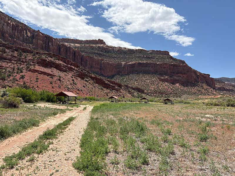
Scenic views at Bedrock Campground in the Paradox Valley. Photo by Nat Cobb.
The initial climb out of the Paradox Valley is steep and rewards riders with expansive views back across the valley below. Dispersed camping is available within Manti-La Sal National Forest, and reliable water can be filtered from Buckeye Reservoir at Pioneer Campground. As the route climbs, the forest returns and temperatures noticeably cool. The climbing eases for a short distance as the route skirts the edge of the La Sal Mountains, meandering through open glades and past small creeks. The final push to the pass is steep, gaining elevation through beautiful forests of aspen, fir, spruce, and pine. Additional camping and water can be found at Dark Canyon Lake. Geyser Pass (10,528 ft./3,208m) marks the final mountain pass of this section and is named after a cattle rancher rather than an actual geyser. From the summit, riders are rewarded with a screaming 6,500-foot (1,981m) descent back to the desert floor in Moab, Utah.
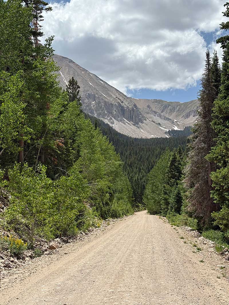
The climb toward Geyser Pass in the La Sal Mountains. Photo by Nat Cobb.
Temperatures rise rapidly with the fast loss of elevation as the terrain transitions from high alpine forest into Moab’s iconic slickrock. Mountain bikers from around the world travel here to ride The Whole Enchilada, a legendary 27-mile (43 km) singletrack descent from Geyser Pass to Moab.
Moab serves as a major tourist hub for nearby Arches and Canyonlands National Parks and is a world-famous destination for off-roading, hiking, mountain biking, and whitewater rafting. Several dry campgrounds line the approach to town within Sand Flats Recreation Area and are primarily used by off-roaders, so be prepared to share the road. Additional campgrounds are available in and around Moab, though they can be crowded during peak spring and fall seasons. Lodging in town is often expensive due to heavy tourism. Take time in Moab to rest, resupply, and address any mechanical needs at one of the town’s many bike shops before continuing, as Section 4 of the Golden Gravel Trail plunges deeper into Utah’s rugged, remote desert.
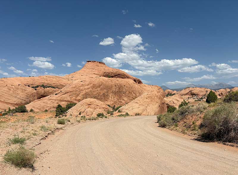
Moab’s iconic slickrock in Sand Flats Recreation Area. Photo by Nat Cobb.
CLIMATE
This section of the Golden Gravel Trail crosses a remarkable range of landscapes and climates, beginning on the open High Plains of southwest Kansas and eastern Colorado, climbing into the heart of the Rocky Mountains, and finishing in the red rock desert of southeastern Utah. Along the way, riders will experience dramatic shifts in temperature, weather patterns, and environmental exposure—sometimes within the same day.
Leaving Elkhart, Kansas, and continuing through Springfield, Las Animas, La Junta, Fowler, and Pueblo, the route travels across the semi-arid High Plains. This region is defined by wide horizons, low humidity, and persistent wind. Summers are hot and exposed, with daytime temperatures frequently climbing above 90°F (32° C) and little natural shade. Afternoon thunderstorms can develop quickly, bringing strong gusts, brief downpours, and hail. A greenish tint to the sky often indicates large hail and is a sign that immediate cover should be sought.
The High Plains of eastern Colorado lie along the western edge of Tornado Alley, with the highest tornado risk occurring from May to August. While tornadoes are relatively rare in this region, severe storms are usually forecast, so riders should monitor weather conditions closely and be prepared to seek shelter in substantial buildings if tornados are imminent. If no shelter is available, move to a low-lying area such as a ditch, lie flat, and protect your head and neck with your arms.
As the route approaches Pueblo and begins to rise toward the Front Range, weather becomes more variable. Temperatures moderate slightly with increasing elevation, though summer heat can still be intense. Thunderstorms become more common, especially in late spring and summer, often building over the nearby mountains in the afternoon. Westcliffe, sitting high in the Wet Mountain Valley, experiences cooler nights and greater daily temperature swings than the lower plains.
From Salida through the high mountain passes toward Crested Butte, riders enter a true alpine environment. Weather in this section is highly changeable, with mild mornings often giving way to afternoon thunderstorms that can bring lightning, hail, and sudden drops in temperature. Even in midsummer, nights can be cold at elevation, and snow is possible on the highest passes at any time outside of peak summer.
Descending into Paonia and Delta, the climate shifts again. This area is drier and sunnier than the high-elevation mountains, with warm days, cool nights, and fewer storms than the eastern side of the Rockies. Agricultural valleys support orchards and vineyards, lending a greener feel near towns, though much of the surrounding landscape remains dry and exposed. Fall brings especially pleasant riding conditions, with mild temperatures and stable weather. As the route climbs onto the Uncompahgre Plateau, temperatures gradually decrease with increasing elevation.
Beyond Nucla, the route enters canyon country where the environment becomes increasingly arid and summer heat can be extreme, often exceeding 100°F (38° C). Shade is scarce, water sources are limited, and careful planning is essential. During the late summer monsoon season, brief but intense storms can cause flash flooding in river canyons and washes.
The climb over the Geyser Pass in the La Sal Mountain provides a brief return to high-elevation alpine conditions before the route drops into the Moab desert. From the summit of Geyser Pass, the climate changes abruptly. The descent to Moab drops over 6,500 feet (1,981m) in elevation in just 34 miles (55 km), and temperatures can rise dramatically (up to 20°F/12° C or more) in just a few hours. Riders may leave the pass wearing multiple layers and reach the slickrock desert in intense heat and sun exposure.
PUBLIC LANDS & CAMPING
This route travels extensively on public land within the Bureau of Land Management (BLM) and the San Isabel, Pike, Grand Mesa, Uncompahgre, Gunnison, and Manti-La Sal National Forests administered by the US Forest Service (USFS). There is an abundance of established campgrounds along the route, ranging from reservable sites with RV hookups and showers, to first-come-first-serve sites with fire rings and pit toilets. Campgrounds are open seasonally and open/close dates will vary. Contact Ranger Districts to confirm status, especially in the shoulder season. To make reservations or get more information on individual US Federal campgrounds, call 877-444-6777 or visit www.recreation.gov.
In addition to established campgrounds, it is legal to camp on USFS and BLM land for free following the guidelines found here: advcy.link/dispersecamp and advcy.link/blmdispersecamp.
REMOTE RIDING CONDITIONS
Many wild, remote stretches exist along this route. High temperatures, inclement weather (including severe thunderstorms, tornadoes, flooding, dust storms, snow, and extremely strong winds), wildfires, and other potential hazards are possible. Understand in advance how to prepare for and cope with them.
East of the mountains on the open plains, drinking water is limited, so replenish your supplies whenever the opportunity presents itself. Plan to carry enough water between towns or established campgrounds with potable water, and do not rely on creeks, rivers, or lakes as primary water sources. Surface water can be contaminated by agricultural runoff, oil and gas activity, cattle grazing, and heavy mineral content. Potential water sources in the form of cattle troughs are marked on the map between Elkhart and Hasty, but they may be dry and should never be fully relied upon.
In the high-elevation alpine mountains, surface water is more common and can be filtered from natural springs, creeks, and lakes. The route becomes more arid in the low desert valleys around Nucla and Paradox. The San Miguel and Dolores Rivers provide reliable water but are often silty, so to protect your filter it’s best to let sediment settle first or pre-filter through a bandana or coffee filter. Individual water sources are only marked on the map where water is scarce or not obvious. Be prepared and plan accordingly.
Pack along bug repellent, sunscreen, and a first-aid kit. Bike shops are available in several towns along this section, but riders should still be prepared for any mechanical possibility. At minimum, carry bicycle tools, a tire pump, and spare tubes, even if riding tubeless.
Most of this route is in black bear country. Always be bear-aware, and follow these rules when camping (these will help ward off other unwanted visitors too, such as raccoons and mice):
- Store all food, garbage, and other attractants in a bear-resistant manner, well away from your tent. This can include hanging them in a stuff sack from rope slung over a high, isolated tree branch, or storing them in a bear-proof container provided at campgrounds.
- Attractants such as food leftovers, fish entrails, and bacon grease should not be buried or burned in campfires. Leftover food and waste should be placed in a sealed bag or container and packed out with garbage. If leftover food or other attractants must be burned, do so in a contained cookstove or in an appropriate container over a campfire, then pack out the ash.
We discourage you from attempting to ride this route solo; in fact, a minimum group size of three is strongly recommended. If a rider is debilitated in the backcountry, you will want to have at least one person to stay with the injured/sick rider, and another to go for help. Be aware that cell phone reception is very spotty along much of the route, and it is recommended to carry a satellite phone in case of emergency.
LAND ACKNOWLEDGEMENT
As we travel by bicycle through these lands, we pause to reflect on our relationship with this place. We ride with respect and honor for the Indigenous peoples who have stewarded these mountains, forests, and waters since time immemorial. We commit to caring for this land by staying on paths, leaving no trace, and listening to the wisdom of the Indigenous peoples, including the Comanche, Kiowa, Cheyenne, Arapaho, Ute, Apache, Navajo, Paiute, and others who call these territories home. May your journey be guided by respect, gratitude, and responsibility.
ACKNOWLEDGEMENTS
Special thanks to Nat Cobb, and his travelling companion Carl Gable, for scouting this route during the summer of 2025. Nat’s notes, insights, and recommendations were invaluable in the creation of this section of the Golden Gravel Trail.
RIDING CONDITIONS
Section 4 of the Golden Gravel Trail begins in the red rock desert of Moab, Utah. Moab serves as a major tourist hub for nearby Arches and Canyonlands National Parks and is a world-famous destination for off-roading, hiking, mountain biking, and whitewater rafting. There is a wide range of camping options in and around town, though they can be crowded during the peak spring and fall seasons. Lodging in town is often expensive due to heavy tourism, so plan accordingly. Riders should address any mechanical needs at one of the town’s many bike shops before continuing, as the next sections are among the most rugged and remote portions of the entire route.
The 70 miles (113 km) from Moab to Green River are rugged, remote, desolate, and strikingly beautiful. Riders should carry ample water and food, as there are no services along the way. Summer temperatures can be brutally hot (up to 105°F/40°C), and the exposed landscape offers no shade. It may be necessary to ride from dawn to mid-morning to avoid the heat of the day. Riders should be prepared to carry up to 7-8 liters of water when conditions demand, or more if covering the distance over two days. In case of emergency, other tourists on the off-roading trails near Moab may be willing to share water, and passing motorists on Interstate 70 could be flagged down for help.
The route leaves Moab on the stunning Moab Canyon Pathway, a paved bike trail that offers a welcome alternative to riding on the shoulder of US Highway 191. If needed, the café at Moab Giants, located one mile off route, provides a final opportunity to refill water before truly leaving civilization. From the highway, the route begins a rugged and heart-skipping climb on a jeep track toward Gemini Bridges. The narrow road clings to the mesa cliffs, with sheer drop-offs revealing expansive views of the surrounding country. Riders with a fear of heights may find this stretch tests their nerves!
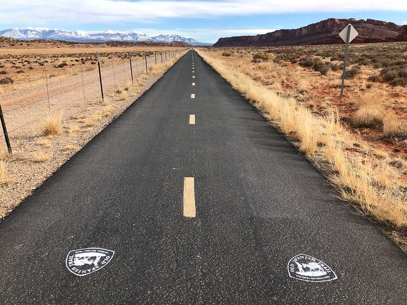
Moab Canyon Pathway. Photo by BLM Utah.
The route alternates between sandy and rocky terrain as it proceeds through scenic Little Canyon and beyond, crossing the dry wash several times. Gemini Bridges lies just off route and is well worth the short detour to view the massive twin sandstone arches. In places, the road runs directly over exposed rock slabs, making for a rough and bumpy ride. Riders should allow extra time through this section and be prepared to walk their bikes for short stretches. The area is popular with off-roading enthusiasts, so expect to share the road. While camping is plentiful, it is restricted to designated sites until closer to Green River. Consult the following map for more information and restrictions on camping in BLM lands south of Interstate 70: advcy.link/BLMmoabcamping. Never camp in dry washes, as flash flooding can occur even when storms are distant.
The Sevenmile Canyon Alternate is 9.7 miles (15.6 km) long, reducing the overall distance between Moab and Green River to 62 miles (100 km). Fully paved with wide shoulders, this alternate avoids the rugged and sandy Gemini Bridges Road while still offering incredible scenery and the chance to see ancient petroglyphs.
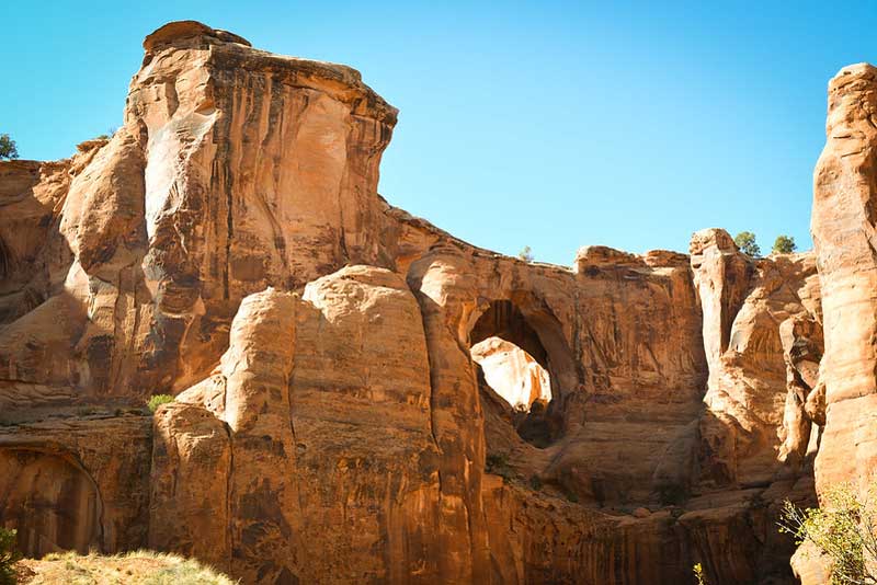
Gemini Bridges from below. Photo by BLM Utah Public Affairs Specialist Ryan Sutherland.
Gemini Bridges Road improves slightly as it approaches Utah Highway 313. The highway features wide shoulders but can carry moderately heavy tourist traffic heading south toward Canyonlands National Park. From there, the route turns north onto a generally good, though washboarded and occasionally sandy road as the landscape opens into broad, scrubby terrain dotted with juniper and sagebrush. A pipeline accompanies the route for several miles, carrying natural gas to a nearby processing facility.
As the route approaches Green River, the landscape becomes increasingly barren, exposed, and desolate. Red rock canyons and cliffs give way to sunbaked sandhills with almost no vegetation, creating a moonscape-like environment. The route crosses Interstate 70 onto the old highway alignment, which features patchy, degraded pavement and almost no traffic. A railroad bridge provides the only substantial overhead shade between Moab and Green River.
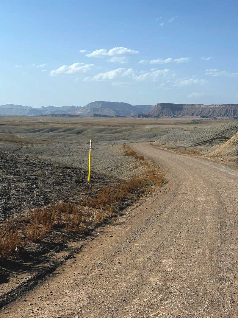
A barren landscape near Green River, Utah. Photo by Nat Cobb.
Green River is a literal oasis in the desert that caters primarily to serving travelers on Interstate 70, as evidenced by the plethora of hotels and fast-food restaurants. The town is famous for its melons, prized for their exceptional sweetness thanks to the region’s sandy soil and desert climate. Green River State Park, located on the banks of the silty river, offers shaded campsites and a chance to shower away the desert dirt and sweat. In 1869, John Wesley Powell and a group of ten men traveled these waters in wooden boats during their expedition to explore the Colorado River and the uncharted Grand Canyon. Riders can learn more about these rivers and Powell’s epic 930-mile (1,497 km) journey at the John Wesley Powell River History Museum in town.
Riders should stock up on ample food and water in Green River before continuing on the route. The next 77 miles (124 km) to Castle Dale travel across the heart of the San Rafael Swell, a giant dome-shaped geologic feature that has been eroded into numerous canyons, mesas, and badlands. The scenery is spectacular, but the landscape and climate are extreme. No services or drinkable water are available, and riders should be prepared to carry up to 7-8 liters of water if the conditions demand. In case of emergency, other tourists in Black Canyon Wash, at the San Rafael River, or in Buckhorn Wash may be willing to share water.
The first 16 miles (26 km) leaving Green River continue through a moonscape of desolate, barren land. Beyond the small airport, the road is largely disused as can be seen by the cracked and crumbling pavement. Utah Highway 24 connects the route to a brief, 2-mile (3.2 km) ride on Interstate 70, which has wide shoulders and relatively low traffic for an interstate. Interstate 70 can also serve as a shortcut from Green River, reducing the overall mileage to Castle Dale by seven miles (11 km), but riders must contend with riding beside fast-moving truck traffic. A small bridge crosses the San Rafael River, and while the water may be tempting in this arid landscape, it is not recommended to drink, even after filtering, due to its brackish quality. After two miles (3 km), the route leaves the interstate via an unofficial dirt road exit. Be sure to close the gate after passing through to prevent cows from wandering onto the highway.
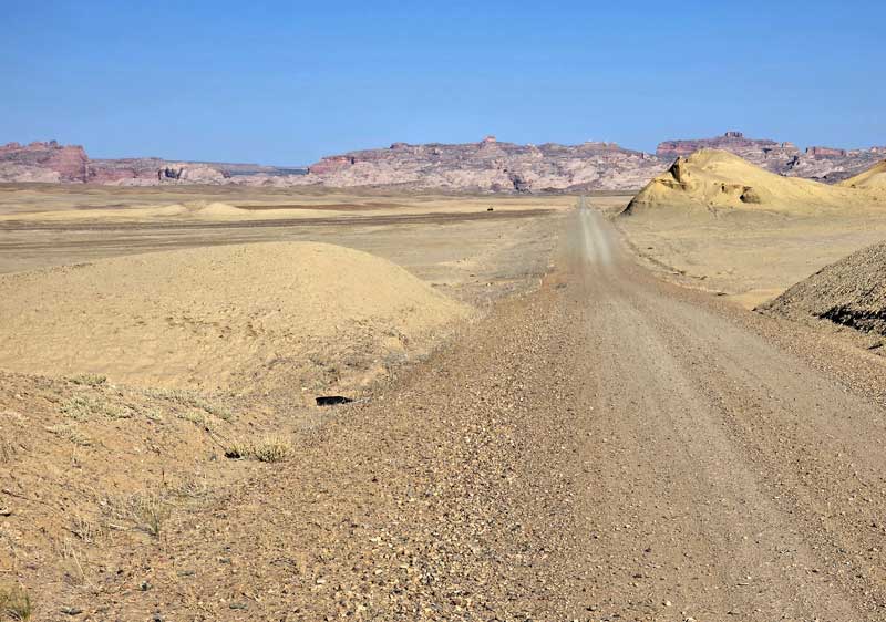
A desolate, moon-like environment between Green River and Black Dragon Canyon. Photo by Carl Gable.
The route officially enters the San Rafael Swell at Black Dragon Wash, a deeply carved, sinuous slot canyon penetrating the impressively rugged terrain. Within the canyon, towering cliffs provide welcome shade, ancient rock art adorns the walls, and the scenery is spectacular. The route follows an unmaintained jeep trail with surfaces that alternate between rocky and sandy, so riders should allow extra time and be prepared to walk their bike for short sections. Flash flooding is possible in the narrow canyon, so riders should stay alert to current weather conditions and forecasts.
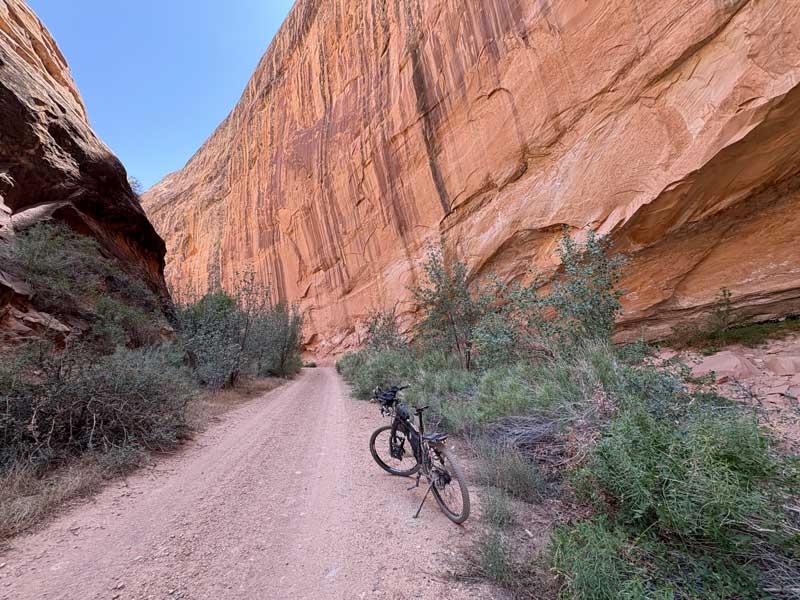
Towering cliffs in Black Dragon Wash. Photo by Nat Cobb.
Black Dragon Road remains rugged but gradually improves as it exits the canyon and heads west toward Buckhorn Draw Road. Buckhorn Draw Road is a well-maintained, smooth gravel road that cuts through the vast, open interior of the Swell, offering expansive views of the surrounding canyons and mesas. Two BLM campgrounds are located at the crossing of the San Rafael River, which, as noted earlier, is not recommended for drinking due its brackish quality and often runs dry anyway. The surrounding scenery at the river crossing is among the most striking of the entire route. Massive red buttes tower above the river in every direction, while clusters of cottonwood trees and tufts of grass trace the riverbanks below. Overnight campers are rewarded with unforgettable sunsets, as shifting light sets the buttes ablaze with color. The historic San Rafael Swinging Bridge, built by the Civilian Conservation Corps in 1937, was once the only crossing over the San Rafael River and remained in use until 1990, when the adjacent bridge was constructed.
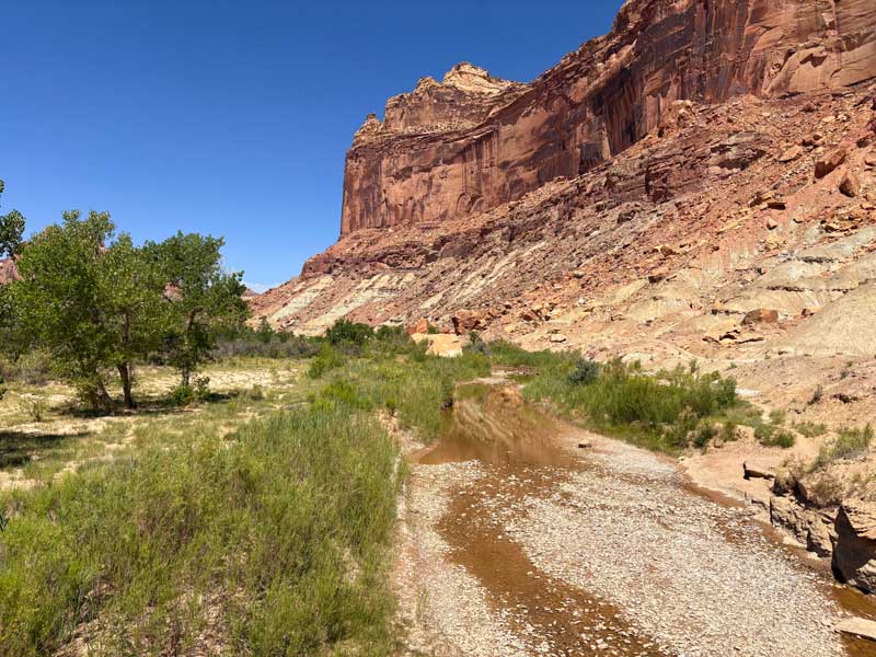
Crossing the San Rafael River in the San Rafael Swell. Photo by Nat Cobb.
From the banks of the San Rafael River, the route begins a gentle climb through the impressive gorge carved by Buckhorn Wash past many designated dispersed campsites. Ghosty red figures drawn by ancient cultures grace the canyon walls, which have been admired — and unfortunately, sometimes vandalized — by travelers for centuries. From the 1830s to the 1850s, pack trains on the Old Spanish Trail passed through the area on the arduous trade route from Santa Fe, New Mexico to Los Angeles, California. Further up the wash, the three-toed footprint of an ornithopod dinosaur can be seen stamped into the sandstone, a reminder that these creatures roamed the land 180 million years ago. After nine miles (14 km), the route tops the draw and emerges onto a vast, sunbaked plain. The nearby Buckhorn Wash Visitor Area offers picnic tables and shade, but no water. A sprawling solar farm marks the route’s re-entry into civilization at Castle Dale.
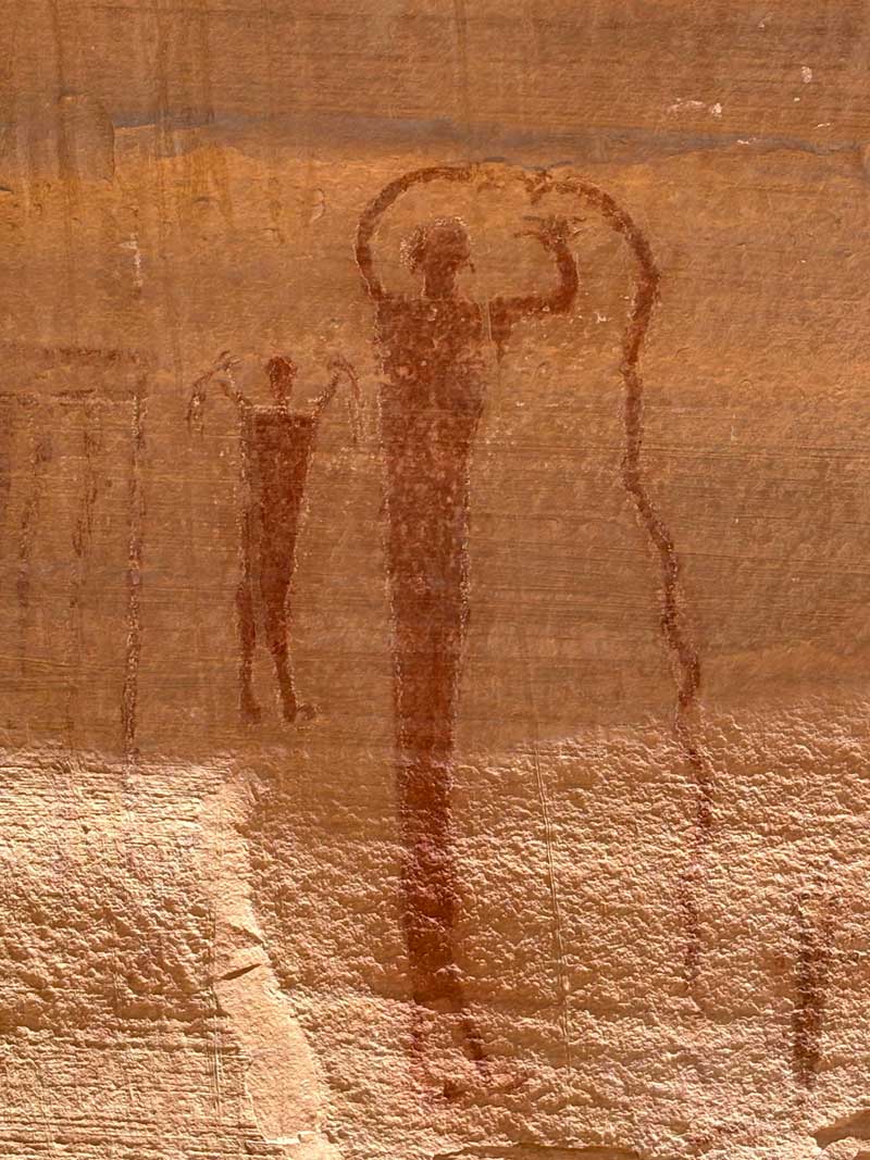
Pictographs in Buckhorn Wash. Photo by Nat Cobb.
The twin towns of Castle Dale and Orangeville offer a welcome reprieve from the desert and serve as an important resupply point for the next portion of the route. The area’s unique geology draws climbers from around the world, attracted by the quantity and quality of bouldering problems in nearby Joe’s Valley. In Castle Dale, the Museum of the San Rafael explores life in the San Rafael Swell, featuring exhibits on prehistoric dinosaurs, Native American cultures, and the Old Spanish Trail. Be sure to stock up on food in town, as it is 180 miles (290 km) to the next full grocery store in Park City, with only limited resupply at Strawberry Bay and Soldier Summit in between.
The 180 miles (290 km) between Orangeville and Park City travel north along the crest of the Wasatch Plateau and into the foothills of the Uinta Mountains. Despite the long stretch with very limited services, the route never feels exceedingly remote. The region is popular with campers, off-roaders, and other vacationers due to its proximity to the Salt Lake City metro area. Additionally, the route crosses two major highways, so other people and potential help are never far. If a bailout is needed, the town of Fairview is just eight miles (13 km) downhill on Utah Highway 31.
Leaving Orangeville, the route follows Utah Highway 29 for 5.8 miles (9.3 km). The highway has no shoulders and can carry heavy traffic, particularly on weekends, so riders should exercise caution. After leaving the highway, the route turns north to climb Cottonwood Canyon, known by local climbers as “Right Fork”. As the road gains elevation, the forest gradually returns, and traffic decreases once the road turns to gravel beyond the Fossil Rock Coal Mine.
Dispersed and developed camping is plentiful in Manta-La Sal National Forest, with water available in small creeks and ponds. This area is popular with campers and off-roaders, so riders should expect to share the road with large trailers and RVs. For the next 44 miles (71 km), the route undulates along the high-elevation ridges and valleys of the Wasatch Plateau, weaving through open sagebrush parks and clusters of aspen.
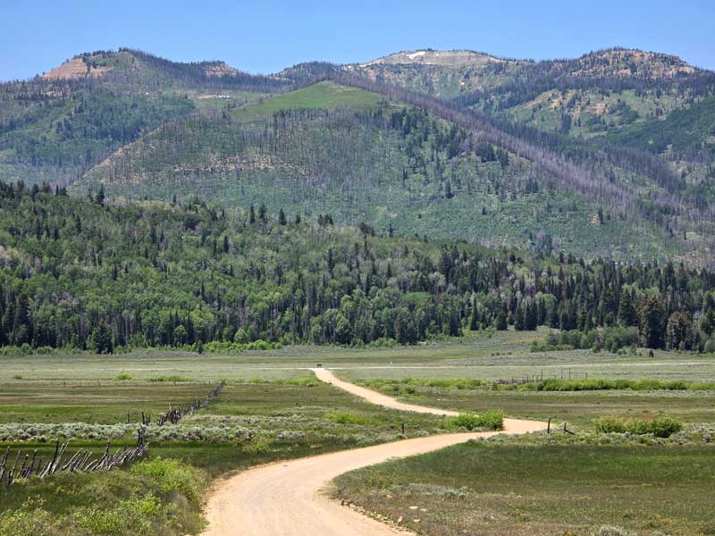
The Wasatch Plateau near Potters Pond Campground. Photo by Carl Gable.
The route reaches Utah Highway 31 at Lake Canyon Recreation Area and turns to climb the summit above Huntington Reservoir. Stock up on water here, as water becomes scarce atop the ridge. During construction of the dam in 1988, a backhoe operator uncovered the bones and tusks of a 10,000-year-old mammoth. The discovery is among the most complete Columbian mammoth skeletons ever excavated and was found at a record-breaking elevation of 9,000 feet for the species, which is typically associated with the lower plains. Utah Highway 31 has moderately wide shoulders and light traffic. A winding ATV trail parallels the highway from the base of the climb to the summit and can be ridden to avoid the highway, but riders should stay alert for oncoming ATV traffic.
Skyline Drive is an incredibly scenic gravel road that traverses the spine of the high, subalpine Wasatch Plateau. In spring and early summer, a variety of wildflowers carpet the landscape, with panoramic views in every direction. Dispersed camping remains plentiful, but no water is available along the ridge, so riders should be prepared to dry camp.
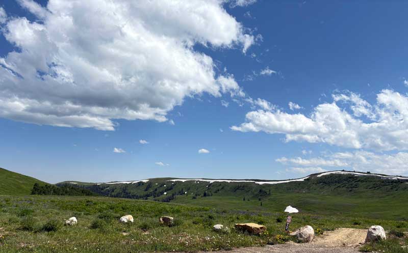
Wildflowers and lingering snowdrifts on Skyline Drive. Photo by Nat Cobb.
A steep descent delivers riders to US Highway 6 in Spanish Fork Canyon. The descent is rough and uneven in places, so ride conservatively and keep speed in check. US Highway 6 has wide shoulders but serves as the primary corridor between Salt Lake City and Denver, resulting in heavy, fast-moving traffic, including trucks and large RVs. Westbound riders (technically eastbound through the canyon) will be cycling uphill along the highway for 7.6 miles (12.2 km), making progress slow. A gas station at Solider Summit provides the first opportunity to restock basic food since Orangeville. Use extreme caution if crossing the highway to access the store.
The climb from Soldier Summit to Willow Creek Ridge in the Uinta National Forest is one of the most challenging of the entire route. The ascent begins gradually through an open valley with a small creek interrupted by numerous beaver dams. The grade steadily increases and becomes especially steep for the final two miles (3 km) to the summit. The road surface is unmaintained, rough, and uneven, so riders should allow extra time for this section and be prepared to spend some time hiking. Once on the ridge, the terrain levels out, but the road remains unmaintained and rough in sections, gradually improving as it descends toward Strawberry Reservoir.
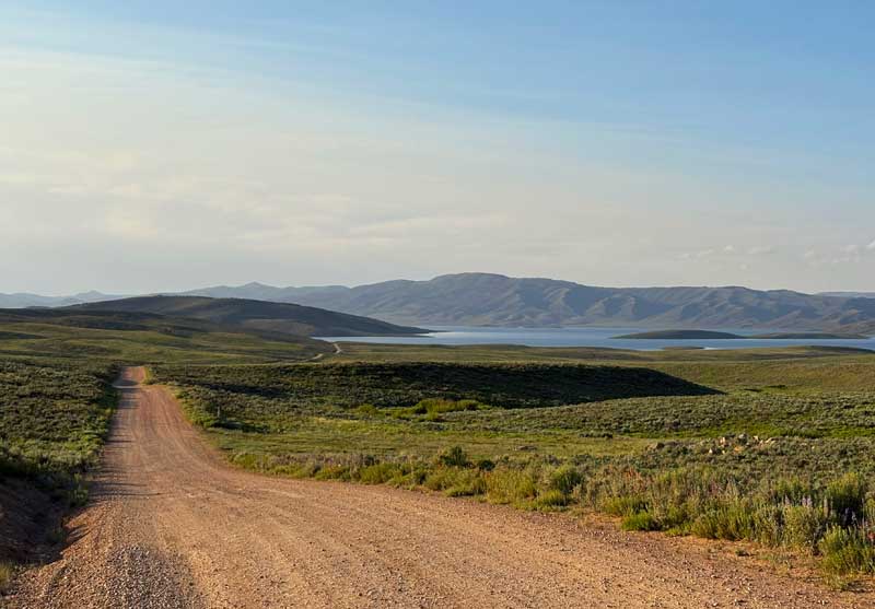
Descending toward Strawberry Reservoir. Photo by Nat Cobb.
The Unicorn Ridge Alternate is fully paved, two miles (3 km) shorter than the main route, and avoids the rough gravel climb to Willow Creek Ridge, but still requires a substantial ascent to access Strawberry Reservoir. This option may be especially appealing to westbound riders, as it involves riding downhill on busy US Highway 6 for 8.8 miles (14.2 km) rather than climbing uphill on the highway for 7.6 miles (12.2 km) on the main route, reducing time spent on this undesirable stretch.
A notable drawback is that the alternate bypasses the gas station at Soldier Summit, and there are no other services available. Traffic is light after leaving the highway, though boat trailers and RVs regularly use these paved roads to access Strawberry Reservoir, so riders should remain alert.
Strawberry Reservoir is a large, high-elevation reservoir long known as one of Utah’s premier fishing and boating destinations. Camping is plentiful, though the area can become busy during the summer months. Stay alert for large RVs and boat trailers on the road. The marina at Strawberry Bay offers a small store that sells snacks and drinks, along with a restaurant serving breakfast, lunch, and dinner.
A short ride on US Highway 40 carries the route into the foothills of the Uinta Mountains, the highest mountain range in Utah. The highway has wide shoulders but can be busy. At the base of Currant Creek Peak, the route reaches its highest point in this section, cresting just over 10,000 feet (3,048m). Snow can linger here well into the season, particularly in the peak’s north-facing basin. Dispersed camping remains plentiful, and water is available in small creeks and ponds. Mill Hollow Campground offers developed campsites beside a small, scenic lake nestled in a serene setting of aspen, fir, and lodgepole pine.
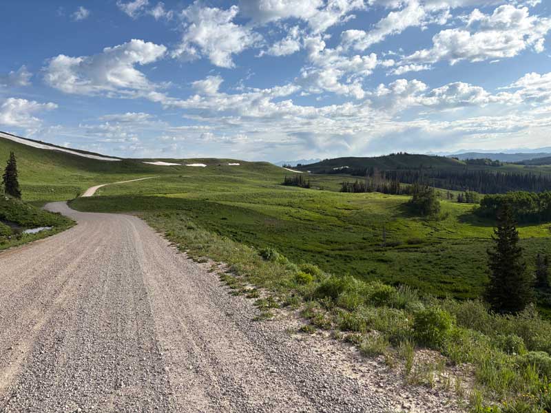
Near the summit at Currant Creek Peak. Photo by Nat Cobb.
Utah Highway 35 has narrow shoulders, but westbound riders will move quickly as they descend through the canyon. Bench Creek Road provides a brief respite from highway riding before the route reconnects with traffic. From Lower River Road, the town of Kamas lies 2.5 miles (4 km) off route to the north and offers services, including a full grocery store, if resupply is needed before continuing to Park City. Utah Highway 32 has moderately wide shoulders but can also be fast and busy.
The route enters Jordanelle State Park near Rock Cliff Campground, which can be accessed via a scenic boardwalk trail over the Provo River. From there, it follows ten miles (16 km) of the Perimeter Trail — a non-motorized trail wider than singletrack but narrower than a typical dirt road. The trail traces the many small bays and inlets of Jordanelle Reservoir and feels surprisingly remote despite its proximity to Park City. Expect several short but very steep sections, along with erosion and loose gravel that may require walking. The trail is shared with horseback riders, so stay alert for horses, slow down, announce your presence, and pass only when the rider signals it’s safe. This section is quite exposed and receives intense afternoon sun reflecting off the lake, making conditions hot, though riders can cool off with a swim if desired. Water can be filtered from the reservoir, but dispersed camping is not allowed within Jordanelle State Park. If short on time or energy, Utah Highway 248 has wide shoulders and can serve as an alternative to the Perimeter Trail, though traffic is heavy and fast.
A six-mile (10 km) out-and-back on the paved Historic Union Pacific Rail Trail delivers riders into the trendy ski town of Park City — the first full-service town since Orangeville and first place to find bike shops since Moab. Famed as the site of the 2002 Winter Olympics and host to the Sundance Film Festival for decades, Park City is a year-round hub for skiing and outdoor recreation. Its vibrant downtown is a tourist hotspot, with world-class art galleries, upscale boutiques, and fine-dining restaurants lining the main street. Lodging in town is often expensive due to heavy tourism, and there is no nearby camping, so plan accordingly.
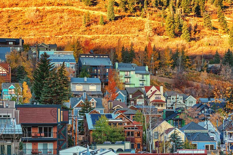
Colorful homes in downtown Park City, Utah. CC Image courtesy of Tony Webster on Flickr.
For 22 miles (35 km) between Park City and Coalville, the route follows the Historic Union Pacific Rail Trail, which transitions from pavement to doubletrack after crossing Utah Highway 248. A striking feature of this trail is a stretch that runs through the median of Interstate 80, a surprisingly wide and wild corridor complete with a small stream. The trail follows the grade of the historic narrow-gauge coal and silver railroad that traversed the region in the 1860s, long before the nearby interstate existed. Sparsely shaded, noisy, and sometimes dusty, it still provides a safe and welcome respite from riding with highway traffic.
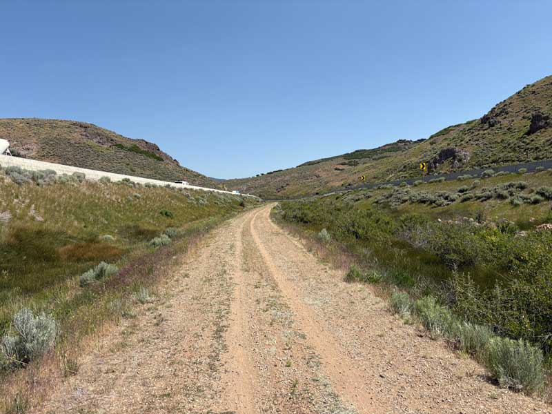
The Historic Union Pacific Rail Trail in the median of Interstate 80. Photo by Nat Cobb.
The small Mormon community of Coalville offers several options for camping and places to grab a bite to eat. From town, the Historic Union Pacific Rail Trail continues a short way off route to Echo State Park with camping available at Dry Hollow Campground on the shores of Echo Reservoir.
Chalk Creek/Yellow Creek Road between Coalville and Evanston, Wyoming is mostly paved yet carries light traffic since most travelers divert to nearby Interstate 80. Camping is not available along this stretch, as the route passes entirely through private rangeland.
Evanston offers full services and is the only town on the route in Wyoming, though the route passes through the state only briefly. North of town, Wyoming Highway 89 has wide shoulders, but they abruptly disappear at the state line as the road becomes Utah Highway 16. Traffic can be fast and heavy along this corridor, so riders should proceed with caution. As the route continues toward Woodruff, quiet county farm roads provide welcome breaks from riding alongside traffic.
At Woodruff, the route turns west to climb into the Monte Cristo Range, a subrange of the much larger Wasatch Range. Utah Highway 39 has narrow shoulders and can carry somewhat heavy summer recreational traffic. Monte Cristo Campground, just off route near the summit, offers the last opportunity for developed camping before reaching Bear Lake.
The route through the Monte Cristo Range in Cache National Forest is rugged in places and very beautiful. Following the crest of the range for many miles, it winds through open grassy parks, shady groves of aspen and mixed conifers, and broad fields of wildflowers. Dispersed camping is plentiful, with water available sporadically in small creeks, ponds, and springs. A steep, staggered descent carries the route down into the small community of Laketown, where a handful of basic services are available at the highway crossroads just north of town.
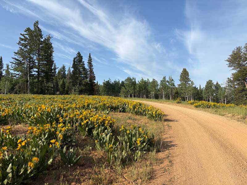
A field of arrowleaf balsamroot in the Monte Cristo Range. Photo by Nat Cobb.
Bear Lake straddles the Utah-Idaho border and is home to several scenic, lakefront state park campgrounds. Sometimes called the “Caribbean of the Rockies,” the lake’s striking turquoise-blue color comes from the refraction of calcium carbonate (limestone) particles suspended in the water. The route along the east shore is fully paved, with a dedicated bike lane for westbound (northbound) riders. Traffic can be busy with recreational users, including large RVs and boat trailers, especially on summer weekends.
North of the lake, the road turns to gravel as it passes alongside the Bear Lake National Wildlife Refuge, which protects 18,000 acres (7,300 ha) of wetlands habitat for waterfowl and other migratory birds. Montpelier, Idaho is a small agricultural town settled in the 1860s by Mormon pioneers traveling the Oregon Trail. The National Oregon/California Trail Center offers a unique and engaging interpretive experience, including a simulation of a wagon journey along the historic trail. Montpelier marks the end of Section 4 of the Golden Gravel Trail, with Section 5 carrying riders across the remainder of Idaho.
CLIMATE
This section of the route crosses one of the most dramatic climate transitions in the American West, beginning in the desert of the Colorado Plateau near Moab and climbing steadily into high mountain and subalpine environments before descending into the agricultural valleys of southeastern Idaho. Riders will experience extreme contrasts in temperature, precipitation, and weather patterns driven primarily by elevation gain and changing geography.
The route starts in the hot, arid desert around Moab, Green River, and the San Rafael Swell, where summers are brutally hot, shade is scarce, and humidity is extremely low. Daytime temperatures commonly exceed 100°F (38°C), and heat exposure is a serious risk. Rainfall is limited, but summer monsoon storms can produce sudden downpours, lightning, strong winds, and dangerous flash flooding in washes and slot canyons. Spring and fall bring more moderate temperatures and generally stable conditions, though winds remain common in open desert basins.
As the route climbs onto the Wasatch Plateau past Castle Dale and Orangeville, the climate shifts rapidly. Temperatures cool with elevation, forests return, and summer days become mild while nights often turn cold, even in midsummer. Afternoon thunderstorms are common, bringing brief but intense rain, hail, and lightning. Snowpack is heavy in winter, and snow can linger into late spring or early summer along Skyline Drive. Spring riding is often limited by snow drifts and muddy roads, while fall brings crisp air, golden aspens, and early-season snowstorms.
After a quick yet significant drop into Spanish Fork Canyon at US Highway 6, the route rapidly returns to a high-mountain climate as it climbs Willow Creek Ridge toward Strawberry Reservoir. Weather becomes highly variable, with rapid shifts in temperature, frequent wind exposure along ridgelines, and storms that can develop quickly. Even in summer, nights can approach freezing, and snowfall is possible at higher elevations outside peak summer months. This section of the route reaches its highest point in Utah at 10,002 feet (3,049m) near Currant Creek Peak, where snow can linger into late spring or early summer, especially in the peak’s north facing basin.
Beyond Coalville and through Evanston, Wyoming, the climate becomes drier, more open, and increasingly wind-prone. Broad valleys and rolling rangeland offer little natural shelter, making strong winds common, especially in spring and early summer. Temperature swings are pronounced, with warm days and cold nights even in midsummer.
Climbing west from Woodruff into the Monte Cristo Range, the route re-enters a true high-mountain environment. Cooler temperatures, frequent afternoon storms, and rapid weather changes are the norm. Fog, wind, and sudden temperature drops are common along the crest of the range, and snow can linger into early summer in shaded basins. Nights are cold year-round at elevation, and frost is possible even during summer months. Descending toward Laketown, the climate moderates slightly but remains alpine-influenced, with cool evenings and variable conditions.
Overall, this segment is defined by extreme climatic contrast, from extreme desert heat to cool alpine forests and wind-swept mountain ridges. Riders may experience 100°F+ (38° C+) desert temperatures and near-freezing mountain nights within the same day. Successful travel through this region requires careful timing, strong weather awareness, layered clothing systems, heat and cold management strategies, and respect for rapidly changing mountain and desert conditions alike.
PUBLIC LANDS & CAMPING
This route travels extensively on public land within the Bureau of Land Management (BLM) and the Manti-La Sal, Uinta, and Cache National Forests administered by the US Forest Service (USFS). There is an abundance of established campgrounds along the route, ranging from reservable sites with RV hookups and showers, to first-come-first-serve sites with fire rings and vault toilets. Campgrounds are open seasonally and open/close dates will vary. Contact Ranger Districts to confirm status, especially in the shoulder season. To make reservations or get more information on individual US Federal campgrounds, call 877-444-6777 or visit www.recreation.gov.
In addition to established campgrounds, it is legal to camp on USFS and BLM land for free following the guidelines found here: advcy.link/dispersecamp and advcy.link/blmdispersecamp.
REMOTE RIDING CONDITIONS
Many wild, remote stretches exist along this route. Extreme temperatures, inclement weather (including severe thunderstorms, flash flooding, snow, and extremely strong winds), wildfires, and other potential hazards are possible. Understand in advance how to prepare for and cope with them.
Reliable surface water in the desert between Moab and Green River and between Green River and Castle Dale is essentially nonexistent, so riders should plan to carry enough water between towns. Do not rely on creeks, rivers, springs, or lakes as primary water sources, even if they appear on a map, as they are often dry or seasonal. The San Rafael River, while tempting in this arid landscape, is brackish and not suitable for drinking, even after filtering.
In the high-elevation alpine mountains, surface water is more common and can be filtered from natural springs, creeks, and lakes. Individual water sources are only marked on the map where water is scarce or not obvious. Be prepared and plan accordingly.
Pack along bug repellent, sunscreen, and a first-aid kit. Bike shops are available in Moab and Park City, but riders should still be prepared for any mechanical possibility at any time. At minimum, carry bicycle tools, a tire pump, and spare tubes, even if riding tubeless.
Most of this route is in black bear country. Always be bear-aware, and follow these rules when camping (these will help ward off other unwanted visitors too, such as raccoons and mice):
- Store all food, garbage, and other attractants in a bear-resistant manner, well away from your tent. This can include hanging them in a stuff sack from rope slung over a high, isolated tree branch, or storing them in a bear-proof container provided at campgrounds.
- Attractants such as food leftovers, fish entrails, and bacon grease should not be buried or burned in campfires. Leftover food and waste should be placed in a sealed bag or container and packed out with garbage. If leftover food or other attractants must be burned, do so in a contained cookstove or in an appropriate container over a campfire, then pack out the ash.
We discourage you from attempting to ride this route solo; in fact, a minimum group size of three is strongly recommended. If a rider is debilitated in the backcountry, you will want to have at least one person to stay with the injured/sick rider, and another to go for help. Be aware that cell phone reception is very spotty along much of the route, and it is recommended to carry a satellite phone in case of emergency.
LAND ACKNOWLEDGEMENT
As we travel by bicycle through these lands, we pause to reflect on our relationship with this place. We ride with respect and honor for the Indigenous peoples who have stewarded these mountains, forests, and waters since time immemorial. We commit to caring for this land by staying on paths, leaving no trace, and listening to the wisdom of the Indigenous peoples, including the Ute, Southern Paiute, Shoshone-Bannock, Eastern Shoshone, and others who call these territories home. May your journey be guided by respect, gratitude, and responsibility.
ACKNOWLEDGEMENTS
Special thanks to Nat Cobb, and his travelling companion Carl Gable, for scouting this route during the summer of 2025. Nat’s notes, insights, and recommendations were invaluable in the creation of this section of the Golden Gravel Trail.
RIDING CONDITIONS
Section 5 of the Golden Gravel Trail begins in Montpelier, in the southeastern corner of Idaho. Situated at the northern end of Bear Lake Valley, Montpelier is a quiet Mormon community once known as Clover Creek by travelers on the Oregon Trail. Riders will find several lodging options in town, with camping available a few miles east up the canyon along US Highway 89.
Leaving Montpelier, the route alternates between short highway segments and farm roads as it travels across the valley bottomlands and climbs into the foothills of the Bear River Range. US Highway 89 offers wide shoulders, but the shoulders narrow beyond Ovid as the route transitions onto Idaho Highway 36.
The route climbs an unnamed pass in the Bear River Range before descending steeply through Ant Canyon on the far side. Dispersed camping is available within Caribou–Targhee National Forest, with water available from North Creek east of the pass.
The route returns to an agricultural setting in rural Gem Valley, named for the obsidian, geodes, quartz, and agates found throughout the area. At the tiny crossroads of Niter, a small convenience store (closed Sundays) offers cold drinks and snacks. Just west of Niter, the route drops down a short but very steep paved hill toward the Bear River. While this presents little issue westbound, eastbound riders may prefer to detour onto Sant Road and Fish Hatchery Road for a more gradual ascent up the benchland, though this bypasses the store at Niter.
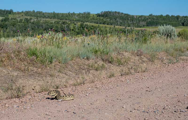
A rattlesnake suns itself on the road. Photo by Jeremy Nolan.
Between Niter and Lava Hot Springs, the route climbs into a broad basin nestled between the Portneuf and Fish Creek Ranges. The final mile to the unnamed pass is rough, rutted, and steep. The surrounding land is primarily private rangeland, so neither dispersed nor developed camping is available. Water sources are scarce and limited to a few tiny creeks and stagnant cattle ponds that may dry up in summer, so plan to carry sufficient water to reach Lava Hot Springs.
Lava Hot Springs is an excellent introduction to the many hot springs that riders will come to enjoy as they travel west across the state. This quaint town offers all the conveniences of a touristy mountain destination, including groceries, restaurants, numerous lodging and camping options, and several developed hot springs. For a unique adventure off the bike, riders can rent a tube and float through town on the rapids of the Portneuf River.
The route leaves Lava Hot Springs on the old alignment of US Highway 30, paralleling the Portneuf River and active railroad tracks. Riders should stock up on water before parting with the Portneuf River, as water is not readily available again until after the significant climb over the Chesterfield Range.
The lightly traveled roads through the broad Portneuf Valley are paved or well-graded as they wind through open farmland. At the north end of the valley, the route passes the ghost town of Chesterfield, a small Mormon settlement founded along the Oregon Trail and abandoned in the 1930s. Many of the historic buildings have been restored or preserved in a state of arrested decay, and today the site operates as a tourist attraction with guided tours and a museum.
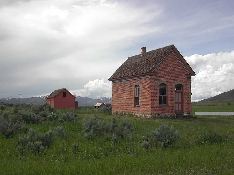
The Tithing House in historic Chesterfield Ghost Town. CC Image courtesy of paulwbond on Flickr.
Leaving Chesterfield, a steep, dry, and exposed climb carries the route over Windy Ridge in the Chesterfield Range. Much of the land along this section is private, so riders should wait until reaching the BLM campsites along the Blackfoot River to spend the night.
Upon descending from Windy Ridge, the route continues along the Blackfoot River through the exposed sagebrush desert characteristic of much of eastern Idaho. This is true big sky country, with few people and expansive views. Several free, well-maintained BLM campsites are located a short distance off route along the riverbank. Popular with flyfishers and families, these sites offer riders a welcome opportunity to dip in the river and wash away the dust accumulated along the trail. The Blackfoot River is heavily used by range cattle, so be sure to filter thoroughly if using it for cooking or drinking.
As the Blackfoot River flows north, it enters an impressive gorge while the road remains perched on the benchlands above. Because of the steep cliffs, riders should expect limited access to the river after Trail Creek Bridge, though the road does cross a few small feeder streams. There are some short, but steep climbs on this stretch as the road weaves through the canyon. The mountains to the west are part of the Fort Hall Indian Reservation, home to the Shoshone-Bannock Tribes of southeastern Idaho.
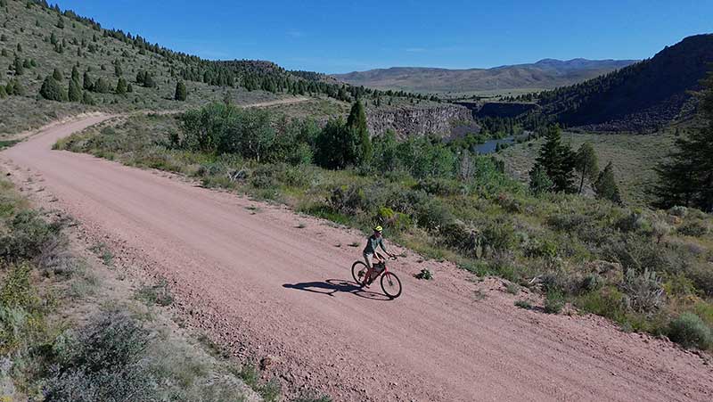
The gorge carved by the Blackfoot River. Photo by Jeremy Nolan.
The route emerges from the hills onto the expansive Snake River Plain as it approaches the city of Blackfoot, known for its unique status as the “Potato Capital of the World.” The Idaho Potato Museum, located downtown in an old train depot, features exhibits on the history and cultivation of potatoes and a cafe with menu items featuring local russet potatoes.
Riders should depart from Blackfoot well stocked with food and water, as the next 73 miles (117 km) to Arco are rugged, exposed, dry, and desolate. Shade is non-existent, summer temperatures can be extreme, and winds are often oppressive. Water is marked on the map in the form of stock tanks that were full and appeared well-serviced as of July 2025. Those choosing not to rely on these tanks may need to carry upwards of 8 liters of water, depending on weather conditions. Riding from dawn to mid-morning may be necessary to avoid the peak heat of the day. Taber Road and US Highway 26 provide a mostly paved alternate from Blackfoot to Arco via Atomic City, with water available at the Big Lost River Rest Area. Shoulders are wide on the highway, but traffic is fast and the landscape remains highly exposed.
For the first 20 miles (32 km) after leaving Blackfoot, the route passes through residential outskirts and potato fields, with traffic gradually decreasing as it heads west. Farmland fades as the route transitions onto the sagebrush grasslands and lava fields of Idaho’s high desert. Big Southern Butte, an important landmark for early explorers, settlers, and travelers, looms on the horizon for hours before the route finally skirts its western base. The butte rises sharply 2,500 feet (762m) above the surrounding plain and is one of the largest volcanic domes in the world, as well as one of the youngest, formed only 300,000 years ago.
Beyond Big Southern Butte, the route passes near the eastern boundary of Craters of the Moon National Monument and Preserve, a landscape shaped by significant volcanic eruptions that occurred as recently as 2,000 years ago. Vast expanses of basaltic lava flows spread across the land, interspersed with cinder cones, open rift cracks, and pockets of sagebrush. In the late 1960s and early 1970s, the lunar-like terrain of Craters of the Moon was used by NASA astronauts training for the Apollo moon landings. The area remains an important location to NASA today, where scientists test rovers and conduct field training for astrobiologists studying the potential for life on other planets.
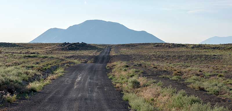
Big Southern Butte rises steeply above the surrounding plain. Photo by Jeremy Nolan.
Road conditions are generally good throughout this section given how remote it is, consisting of gravel or crushed basalt doubletrack with a few minor rocky stretches. Much of the surrounding land is managed by the BLM, so dispersed camping is plentiful, including several wind-sheltered sites in an old quarry at the southeast base of Big Southern Butte.
The scientific significance of the route continues as riders enter the sleepy town of Arco. In 1955, Arco became the first city in the world to be powered by electricity generated from nuclear energy, produced at the nearby Idaho National Laboratory. Arco has several resupply options and at least one developed camping option.
From Arco, the route follows quiet farm roads until it begins climbing into the foothills of the Pioneer Mountains. This is yet another extremely remote section of the route, with few people venturing into these far reaches of Central Idaho. The landscape is dominated by broad valleys and sagebrush hills, with few trees to offer protection from the sun and wind. Thirsty riders may be tempted to filter water from Champagne Creek, but it is contaminated with heavy metals from nearby mining as indicated by posted signs. Better sources can be found a few miles north in Bear and Antelope Creeks.
Bear Creek Summit is the first of three passes that riders will cross before reaching Ketchum. The climb is short but very steep and exposed, with expansive views of the surrounding sagebrush hills. From the summit, the route descends into a small canyon before turning west along Left Fork Cherry Creek to begin the climb over Antelope Pass. This pass is rocky, exposed, and among the steepest on the entire route. Allow extra time and be prepared to walk your bike if needed. The descent from Antelope Pass is equally rocky until the junction with East Fork Road, where riders will encounter Copper Basin Guard Station and the start of several backcountry ranches and vacation homes. Countless dispersed camping opportunities can be found along the East Fork of the Lost River within Salmon-Challis National Forest.
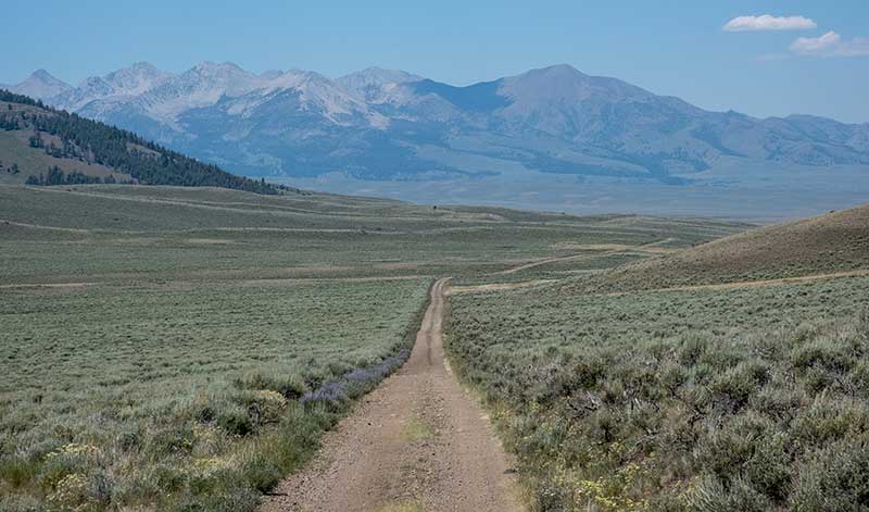
Near Antelope Pass. Photo by Jeremy Nolan.
Road conditions improve considerably from the junction of East Fork Road and remain good all the way to the paved descent into Ketchum. The final climb over Trail Creek Summit is gradual and passes two Forest Service campgrounds that may be the best options for riders hoping to camp near town. Closer to Ketchum, campgrounds become crowded and dispersed camping, though permitted, is generally discouraged by locals. The last opportunity for dispersed-style camping before Ketchum is along Corral Creek, where primitive camping is limited to designated sites only. Water is available in several creeks on both sides of the pass.
The descent from Trail Creek Summit into Ketchum is mostly paved and offers spectacular views down the canyon. For the final miles into town, the route joins the Sun Valley Trail, a paved multi-use path leading directly into downtown, where many options for lodging and resupply await.
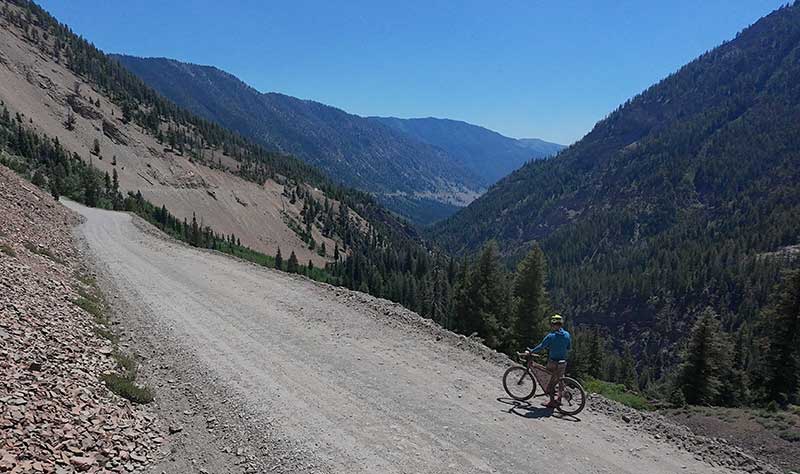
Descending from Trail Creek Summit into Ketchum. Photo by Jeremy Nolan.
Originally a mining town, Ketchum later emerged as a major sheep-shipping center before reinventing itself as a premier winter destination with the 1936 opening of Sun Valley Ski Resort, home to the world’s first chairlift. The new resort quickly became a playground for wealthy families, politicians, and celebrities such as Clark Gable, Gary Cooper, Marilyn Monroe, and Ernest Hemingway who helped cement Sun Valley’s reputation as one of America’s most glamorous ski destinations. In the summer, the slopes open to mountain biking, and several bikes shops in town can help with rentals or repairs.
Riders should stock up on ample food and supplies before leaving Ketchum, as the next full-service town is 157 miles (253 km) away in Idaho City and separated by three major mountain passes. Water is generally plentiful in creeks and rivers along the route, but food resupply is limited to small stops in Smoky Bar, Featherville, and Twin Springs.
170 miles (274 km) of the route from Ketchum to Placerville overlap with a spectacular portion of another Adventure Cycling route, the Idaho Hot Springs Mountain Bike Route (IHSMBR). The IHSMBR is a 517-mile (832 km) loop through the mountains of central Idaho, developed in 2014 to showcase some of the state’s 300+ natural hot springs. Riders on the Golden Gravel Trail will encounter more than a dozen geothermal pools between Ketchum and Idaho City, with the highest concentration along the Middle and Main Forks of the Boise River.
Hot springs are fragile natural resources and should be treated with care. To help keep them as pristine as possible, please observe all posted rules and regulations at each site. Do not use soap in the springs, including biodegradable varieties. Stay well hydrated, as cycling combined with hot spring use can lead to severe dehydration. Several pools are located on the far side of the river and require fording to access. Use extreme caution and sound judgment when visiting these springs, and only cross when water levels are low and safe.
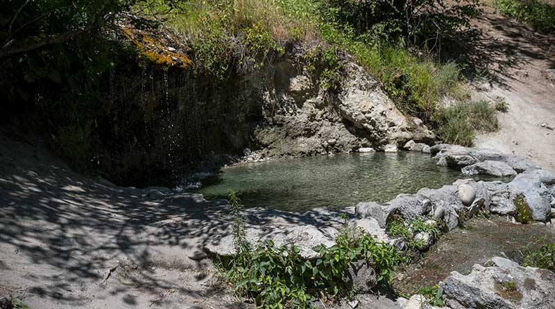
Loftus Hot Springs. Photo by Jeremy Nolan.
Several miles west of Ketchum, riders pass the first natural hot spring at Frenchman’s Bend, a lovely undeveloped soaking spot located right along the road. The climb up Dollarhide Summit (8,719 ft./2,658 m) is relatively gradual compared to the passes east of Ketchum. Road surfaces are generally higher quality, with fewer stretches of loose, chunky rock. Shade also becomes more abundant as the route enters increasingly forested terrain. This portion of the route travels through Sawtooth National Forest, with many dispersed and developed campsites available.
Riders are rewarded with a long, 44-mile (71 km) descent to the small community of Featherville on the South Fork of the Boise River. Along the way, several hot springs provide opportunities to soak after a long day in the saddle, including Worswick, Preis, and Baumgartner. Baumgartner is more developed and can be busy with visitors from the Treasure Valley, but Preis and Worswick are each significantly less frequented and more primitive. The store at Smoky Bar offers snacks along with a small selection of camping and bike supplies, but otherwise no services are available until Featherville.
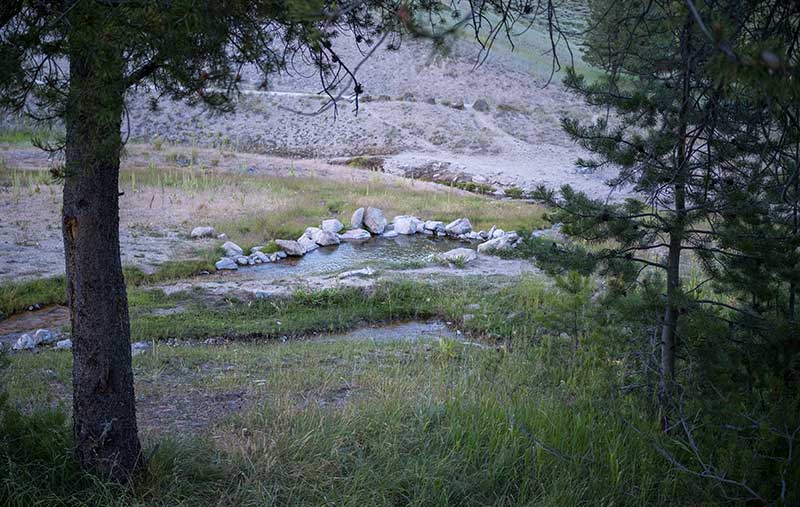
Worswick Hot Springs. Photo by Jeremy Nolan.
Recreational activity increases as riders approach Featherville, with families camping, fishing, and side-by-sides and ATVs sharing the road. Featherville is small but has basic services, including a general store, restaurant, and motel.
Leaving Featherville, the route enters the Boise National Forest and begins a long, rocky climb over an unnamed pass below Steel Mountain. The subsequent descent to the Middle Fork of the Boise River is notably steep and rough, with a series of tight switchbacks dropping into Phifer Creek Canyon.
The route follows the Middle and Main Forks of the Boise River for 36 miles (58 km), passing a string of hot springs, Forest Service campgrounds, and dispersed campsites. This gravel road sees heavy recreational traffic from the Boise area and can be severely washboarded as a result. Basic snacks and drinks can be found at Twin Springs Resort, just before the river enters the upper reaches of Arrowrock Reservoir.
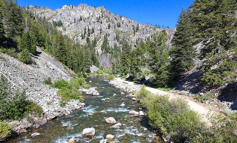
The Middle Fork of the Boise River. Photo by Jeremy Nolan.
The climb from the Boise River up and over the unnamed pass near Bald Mountain to Idaho City is long, dry, and steep. The upper reaches of the ascent are particularly beautiful, almost alpine in feel, with wildflower meadows and expansive views in every direction. A dry campground is located near the summit, with additional dispersed options along Pine Creek closer to Idaho City. Be sure to refill water before tackling the pass, as sources are scarce along the high ridgelines.
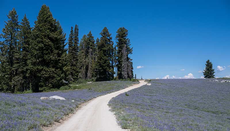
A field of lupine near Bald Mountain. Photo by Jeremy Nolan.
Idaho City is a former gold mining town that, during its heyday in the 1860s, was the largest city in the Northwest—even larger than Portland, Oregon. Today the town is lined with historic wooden buildings from that era, preserving an authentic old-Western feel. Full services are available for rest and resupply, including a commercial hot springs resort.
A short gravel climb brings the route into the vicinity of New Centerville and Placerville, where the surface briefly returns to pavement past numerous summer homes tucked into the woods. The route then climbs over Harris Creek Summit (5,214 ft./1,589m) on a well-maintained gravel road, becoming progressively drier and less shaded as it leaves the National Forest and descends toward the Payette River. Water is available in small creeks on both sides of the pass. Horseshoe Bend offers several convenience stores and restaurants, though more substantial services are available 18 miles (29 km) farther in Emmett.
A very nice campground managed by the Bureau of Reclamation is located at Montour and is one of the few campgrounds along this portion of the route. Private property is more prevalent in these agricultural lowlands, so riders will need to rely on established campgrounds marked on the map or find lodging in nearby towns.
Between Horseshoe Bend and Emmett. Photo by Jeremy Nolan.
Idaho Highway 59 leaving Emmett across the Payette River is narrow and busy with local traffic. The route detours onto rural residential roads to avoid this congestion before heading into the dry, grassy hills north of town. This area is popular with off-roading, so stay alert for large trailers on the road.
The route crosses the Payette River again and begins a zigzagging approach along quiet farm roads and through suburban neighborhoods to the section end in Payette. Just across the state line in Oregon, Ontario offers a larger variety of services and accommodations. Riders should use caution if crossing the Snake River to reach the city. US Highway 30 has wide shoulders, but traffic is heavy. Section 5 concludes in Payette, Idaho, where the Golden Gravel Trail turns west toward the vast and varied landscapes of Oregon—the journey’s final state.
CLIMATE
This section of the route crosses several distinct climate zones, beginning in the cooler, higher-elevation valleys of southeastern Idaho and ending in the warm, dry agricultural lowlands near the Oregon border. In between, the route crosses several high passes with variable mountain weather, including cold mornings, afternoon thunderstorms, and the possibility of lingering snow into early summer.
The crossing near Craters of the Moon between Blackfoot and Arco is one of the most climatically extreme portions of the route, with virtually no shade and dark volcanic rock that absorbs heat and intensifies daytime temperatures. Summer highs regularly exceed 90°F (32°C), and strong afternoon winds are common across the open lava fields. Nights can cool rapidly due to the elevation and arid conditions, and reliable water sources are extremely limited.
West of Arco, the route climbs back into higher elevations over Antelope Pass and Trail Creek Summit near Ketchum, where temperatures are cooler and conditions more variable. Summer thunderstorms are frequent, and temperatures can drop quickly with elevation, especially overnight. The forested mountains between Ketchum and Idaho City tend to be cooler and more shaded, though wildfire smoke has become increasingly common in mid- to late summer.
As the route descends toward Emmett, Ontario, and Payette, the climate becomes progressively warmer and drier. Summer temperatures in the lower valleys often exceed 90°F (32°C), with long exposed stretches and limited shade.
PUBLIC LANDS & CAMPING
This route travels extensively on public land within the Bureau of Land Management (BLM) and the Caribou-Targhee, Salmon-Challis, Sawtooth, and Boise National Forests administered by the US Forest Service (USFS). There is an abundance of established campgrounds along the route, ranging from reservable sites with RV hookups and showers, to first-come-first-served sites with fire rings and vault toilets. Campgrounds are open seasonally and open/close dates will vary. Contact Ranger Districts to confirm status, especially in the shoulder season. To make reservations or get more information on individual US Federal campgrounds, call 877-444-6777 or visit www.recreation.gov.
In addition to established campgrounds, it is legal to camp on USFS and BLM land for free following the guidelines found here: advcy.link/dispersecamp and advcy.link/blmdispersecamp.
REMOTE RIDING CONDITIONS
Many wild, remote stretches exist along this route. Extreme temperatures, inclement weather (including severe thunderstorms, flooding, snow, and extremely strong winds), wildfires, and other potential hazards are possible. Understand in advance how to prepare for and cope with them.
Individual water sources are only marked on the map where water is scarce or not obvious. Be prepared and plan accordingly. Aside from the exposed crossing of Craters of the Moon between Blackfoot and Arco, where reliable water is extremely limited, resupply is generally straightforward with thoughtful planning.
Pack along bug repellent, sunscreen, and a first-aid kit. Bike shops are available in Ketchum, but riders should still be prepared for any mechanical possibility. At minimum, carry bicycle tools, a tire pump, and spare tubes, even if riding tubeless.
Most of this route is in black bear country. Always be bear-aware, and follow these rules when camping (these will help ward off other unwanted visitors too, such as raccoons and mice):
- Store all food, garbage, and other attractants in a bear-resistant manner, well away from your tent. This can include hanging them in a stuff sack from rope slung over a high, isolated tree branch, or storing them in a bear-proof container provided at campgrounds.
- Attractants such as food leftovers, fish entrails, and bacon grease should not be buried or burned in campfires. Leftover food and waste should be placed in a sealed bag or container and packed out with garbage. If leftover food or other attractants must be burned, do so in a contained cookstove or in an appropriate container over a campfire, then pack out the ash.
We discourage you from attempting to ride this route solo; in fact, a minimum group size of three is strongly recommended. If a rider is debilitated in the backcountry, you will want to have at least one person to stay with the injured/sick rider, and another to go for help. Be aware that cell phone reception is very spotty along much of the route, and it is recommended to carry a satellite phone in case of emergency.
LAND ACKNOWLEDGEMENT
As we travel by bicycle through these lands, we pause to reflect on our relationship with this place. We ride with respect and honor for the Indigenous peoples who have stewarded these mountains, forests, and waters since time immemorial. We commit to caring for this land by staying on paths, leaving no trace, and listening to the wisdom of the Indigenous peoples, including the Shoshone-Bannock, Northern Paiute, Cayuse, Umatilla, Walla Walla, and others who call these territories home. May your journey be guided by respect, gratitude, and responsibility.
ACKNOWLEDGEMENTS
Special thanks to Jeremy Nolan for scouting this route during the summer of 2025. Jeremy’s notes, insights, and recommendations were invaluable in the creation of this section of the Golden Gravel Trail.
RIDING CONDITIONS
Section 6 of the Golden Gravel Trail begins in Payette, Idaho. A bridge over the Snake River carries the route into Oregon, the eighth and final state of the journey. Heading north and west, the route weaves through the fertile farmlands of the Snake River Plain, where the scent of sweet onions often lingers in the air.
The town of Weiser, located just off route back across the river in Idaho, offers additional services and is the last full-service town near the route until Canyon City and John Day. As the route leaves the Snake River Plain, irrigated farm fields gradually give way to dry, grassy hills dotted with sagebrush, signaling the transition into Oregon’s high desert landscape. Two campgrounds lie along the shores of the Snake River, including one private campground and one free BLM site.
The Snake River. Photo by Jeremy Nolan.
The route joins Interstate 84 for a mandatory, 2.7-mile (4.4 km) stretch, as no other gravel or secondary roads exist in the area. The interstate features wide shoulders, though a guardrail between the roadway and river in the westbound direction can make the ride feel constricted. Both directions include a rumble strip separating cyclists from traffic, which is generally moderate for an interstate. Watch carefully for debris in the shoulder. After exiting the interstate, a truck stop provides basic provisions before the route continues deeper into the remote landscapes of eastern Oregon.
The route crosses into the Pacific Time Zone just north of the truck stop. Westbound riders should set their watches back one hour; eastbound riders move them ahead one hour.
In the mid-1800s, Farewell Bend was a critical stop for travelers on the Oregon Trail preparing to head overland toward the Columbia River. Today, the area is a state recreation area with camping facilities and a popular launch site for float trips. For a less developed overnight option, dispersed campsites and a small BLM campground are located off route along the Snake River approximately three miles (5 km) east of Huntington.
Between Farewell Bend and Huntington, the route follows a gravel road for two miles (3.2 km) with signs indicating private property on either side of the roadway. Remain on the road at all times and be sure to close the gates behind you.
Huntington is the last town on the route until Canyon City and John Day, 137 miles (220 km) to the west. The town has a small general store, though the truck stop at the interstate offers a wider selection of supplies and may be a better option for stocking up before continuing. No other services are available until Canyon City, but water can be found in small creeks with some careful planning.
The route leaves Huntington and heads into remote, scenic countryside, with rolling hills of tall grasses swaying in the wind. The gravel roads are generally in good condition but can become muddy after heavy rainfall. Water is available at Basin Creek, with a more reliable source just off route at Willow Creek. Dispersed camping on BLM land is permitted along Willow Creek.
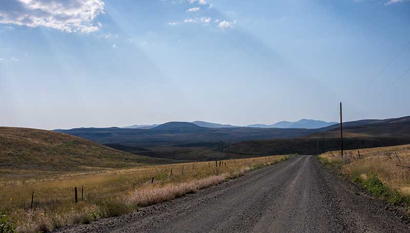
Grassy hills west of Huntington. Photo by Jeremy Nolan.
Malheur Reservoir was built in the 1930s to irrigate farmland downstream and is now a refuge for a variety of birds and other wildlife. Several dispersed campsites are located along the reservoir, though riders should avoid filtering water or swimming due to a history of toxic algae blooms.
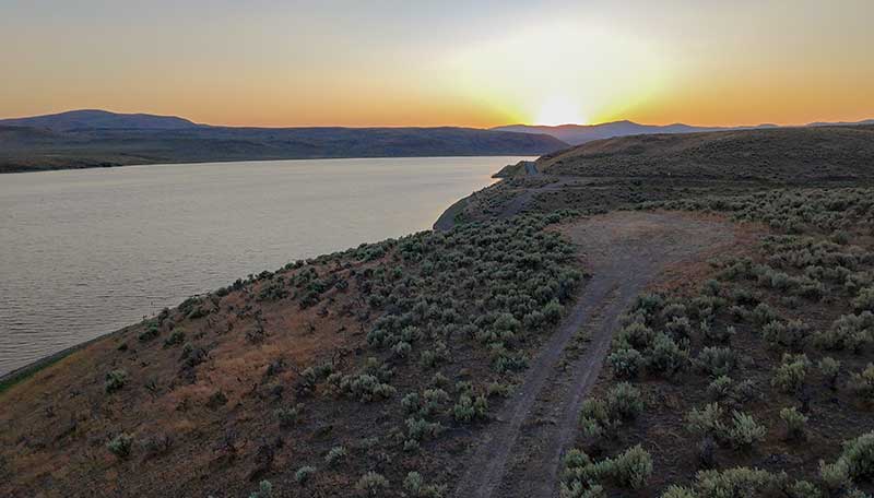
Sunset at Malheur Reservoir. Photo by Jeremy Nolan.
The route continues up Willow Creek, passing more remote ranches and sagebrush-covered hills. There are no services available at Ironside, where the route crosses US Highway 26. The surface becomes rougher and chunkier after crossing the Little Malheur River until reaching pavement at Forest Road 16 in the Malheur National Forest.
Forest Road 16 is a narrow, paved road with very little traffic that winds through the heart of Malheur National Forest. Dispersed and developed camping opportunities are plentiful, with water regularly available in small creeks.
At the crossing of the North Fork Malheur River, riders have the option to divert onto the Prairie City Alternate. This 37.7-mile (61 km) alternate is entirely paved and shortens the distance between services to a more manageable 102 miles (164 km), compared with the 137-mile (220 km) stretch on the main route. Prairie City is a quaint western town with basic services, located at the eastern end of the John Day Valley. US Highway 26 has moderately wide shoulders and is shared with riders on the TransAmerica Trail, so locals are accustomed to seeing cyclists on the road.
Back on the main route, the route continues along paved Forest Road 16, traversing the forested ridges and broad valleys of the Strawberry Mountains. Water and camping opportunities are plentiful throughout this stretch.
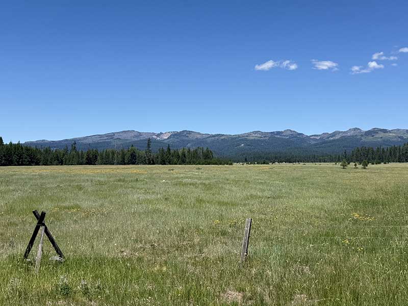
Looking north from Logan Valley toward the Strawberry Mountains. Photo by Denny Koontz.
Before descending into John Day, the route detours onto a gravel road tracing the spine of Starr Ridge in the Aldrich Mountains. This road offers sweeping views over Bear Valley and passes the active Dry Soda Fire Lookout Tower. Water is scarce atop the ridgeline, so expect to dry camp if planning to spend the night. The descent down the narrow gulch to Canyon Creek is short but steep and may have minor washouts, so keep speed in check. If short on time or energy, this unpaved section can be easily bypassed by remaining on paved Forest Road 15 (County Road 65) past Wikiup Campground.
The route turns onto US Highway 395 for the final descent into John Day, with a brief detour onto parallel residential streets in Canyon City. The highway has narrow shoulders and several S-curves through the canyon, so ride with caution. Canyon City offers basic services, with more extensive amenities a few miles north in John Day.
John Day sits on the banks of the John Day River, the longest undammed tributary of the Columbia River and one of the longest free-flowing rivers in the continental United States. The town and river were named for John Day, a Virginian member of the Pacific Fur Company’s 1811 overland expedition to Astoria on Oregon’s coastline. By 1887, the town of John Day was home to nearly 1,000 Chinese immigrants drawn to the area by the promise of gold. The Kam Wah Chung & Co. Museum tells the story of early Chinese culture in the region and is one of the premier surviving examples of a 19th century Chinese apothecary.
The Chinese apothecary at Kam Wah Chung & Co. Museum in John Day. CC image courtesy of lamblukas on Flickr.
Riders should stock up on enough food and supplies in John Day to cover the next 125 miles (201 km) to Mitchell. No other services are available, aside from limited resupply in Mount Vernon, just eight miles (13 km) west of John Day. With careful planning, water should not be an issue along this stretch and can be reliably found in several small creeks and springs.
The route leaves John Day on US Highway 26, which has moderately wide shoulders and is shared with cyclists on the TransAmerica Trail. Clyde Holliday State Recreation Site is a wonderful overnight option, offering shady, grassy campsites along the banks of the John Day River.
At Mt. Vernon, the route turns south to begin a long gravel climb into the Aldrich Mountains within the Malheur National Forest. This stretch toward Mitchell is extremely remote, characterized by steep climbs to high ridgelines, short traverses across broad, high-elevation basins, and winding descents to small creeks. Dispersed camping is widely available, though riders should use caution if camping in burned areas as wind can easily topple dead trees. The views from some of the upper ridgelines are spectacular, looking west toward the foothills of the Cascades and south across the remote valleys of central Oregon. Near the crossing of the South Fork John Day River, the route transitions into the Ochoco Mountains within the Ochoco National Forest.
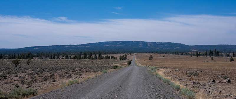
Looking north into the Ochoco Mountains near the South Fork John Day River. Photo by Jeremy Nolan.
A long, beautiful descent delivers riders into the tiny town of Mitchell, a charming stop along US Highway 26 that serves as a gateway to adventures in the Painted Hills and surrounding mountains. The town offers a small general store, a few restaurants, and camping in the city park. No bike tour through Mitchell is complete without visiting Spoke’n Hostel, housed in a restored church on the edge of town. Since 2016, the hostel has welcomed thousands of TransAmerica Trail cyclists and bikepackers exploring Oregon’s bicycle routes.
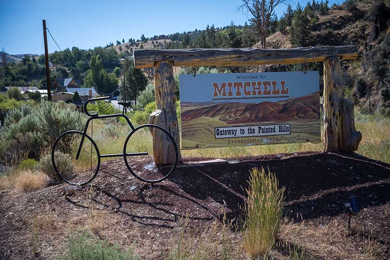
The bicycle-friendly town of Mitchell, Oregon. Photo by Jeremy Nolan.
The route departs Mitchell on US Highway 26, once again shared with the TransAmerica Trail, before turning onto West Branch Road to reenter the Ochoco National Forest. A dry Forest Service campground sits near the summit of this climb, after which the route descends back to US Highway 16 at Ochoco Pass, where water spigots are available at Ochoco Divide Campground.
From Ochoco Pass, the route climbs a high ridge along the northern edge of the Mill Creek Wilderness, offering fleeting glimpses of the Three Sisters far to the west. These volcanic peaks serve as prominent landmarks and signify a shift in geography and climate as the route approaches the Cascades. The road begins as pavement and transitions to dirt near the high point, which is rutted and bumpy in places. Two small campgrounds are available atop the ridge, with potential water at a spring at the south end of Bingham Springs Campground. Otherwise, water is not reliably available again until McKay Creek on the descent toward Prineville.
Prineville is the largest town on the route since Ontario and remains the largest town for the rest of Oregon. All services are available here, including a bike shop as of 2026. Prineville is also the final resupply town that riders will share with the TransAmerica Trail before the two routes diverge. The next opportunity for food resupply is in La Pine, 107 miles (172 km) to the southwest, with only limited provisions available in between at East Lake Resort.
From Prineville, the route heads south onto the Lower Crooked River Back Country Byway, a paved road that winds through an exceptionally scenic river canyon. The byway has no shoulders and can see heavy recreational traffic, but it’s still popular with local cyclists. A series of BLM campgrounds line the river, offering shade and easy access to water. Boaters also use this road to reach Prineville Reservoir, so be alert for trailers and RVs.
Leaving the river, the route climbs to the top of Bowman Dam, which forms Prineville Reservoir. Riders should stock up on water here, as no reliable sources are available for the next 67 miles (108 km) until East Lake. Beyond the reservoir, the road turns to gravel and crosses a lonesome, dry, and exposed sagebrush plain. In case of emergency, passing vehicles on US Highway 20 may be flagged down for water.
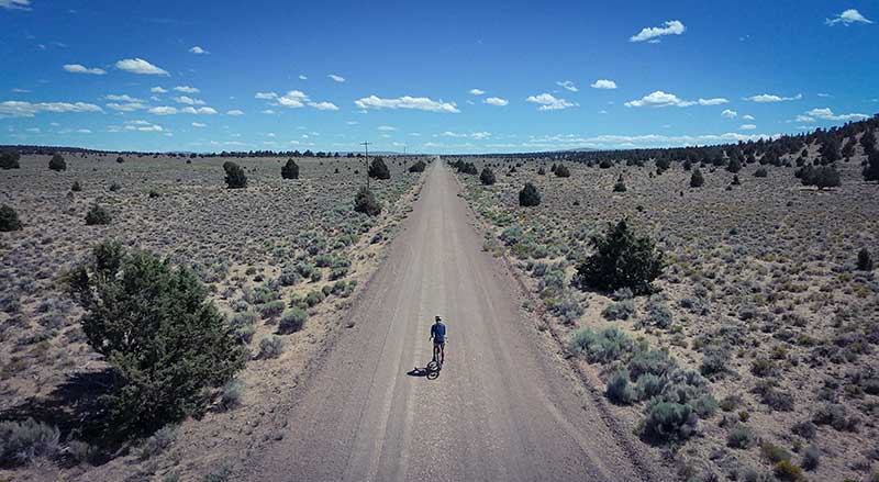
The vast plain between Prineville Reservoir and Sand Springs. Photo by Jeremy Nolan.
The route continues south on gravel roads through remote ranchland, passing several small volcanic buttes that signify the official entry into Oregon’s volcanically active Cascade Range. These buttes formed when small eruptions built up layers of magma atop ash and cinder, then slowly eroded over millions of years. Much of the soil in this region consists of pumice from these eruptions, making it highly porous and poor at retaining surface water. As a result, an important landmark for riders and wildlife alike is Sand Springs, one of the few natural water sources for many miles. The small, stagnant pond is seasonal and may dry up in some years, so it should not be relied upon as a guaranteed source of water. This region is part of the Deschutes National Forest, and a primitive campground is located at the springs.
The red cinder and pumice roads in this area can be washboarded and sandy, slowing progress. In some stretches, the forest grows dense with young trees, and the combination of limited visibility through the understory and minimal terrain variation can make the ride feel slightly monotonous. Off-roading recreation is popular here, so stay alert and listen for oncoming vehicles on the narrow, twisting roads. This remains important all the way to the coast, as off-road traffic generally increases from this point westward.
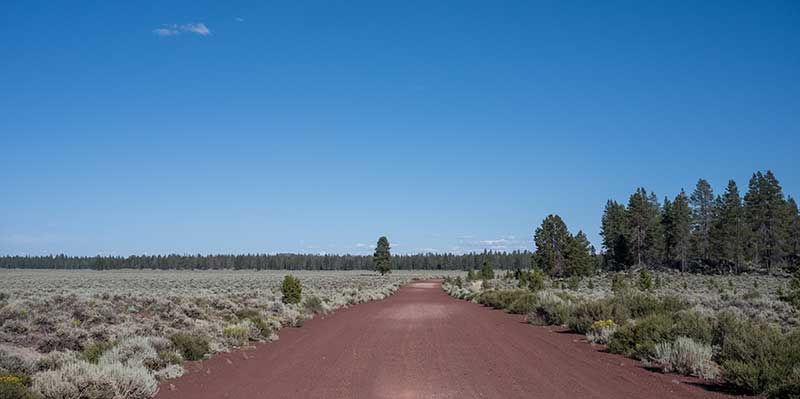
A red cinder road near Sand Springs. Photo by Jeremy Nolan.
A steady, steep climb brings riders to the route’s highest point in Oregon before descending into Newberry National Volcanic Monument. At its center rises Newberry Volcano, a broad shield volcano and the largest volcano by area in the Cascades. The lava flows from this volcano blanket nearly 1,200 square miles (3,100 km²), roughly the size of Rhode Island.
Two lakes sit within the volcano’s caldera—East Lake and Paulina Lake—both offering camping and lodging options along their shores. Dispersed camping is not permitted within monument boundaries.
The paved road through the monument can see heavy recreational traffic, so stay alert for RVs and boat trailers. A small convenience store at East Lake Resort offers limited resupply for riders passing through. Just beyond Paulina Lake, riders can take a short break from the bike to hike to Paulina Falls, a set of waterfalls that plunge 80 feet (24 m) to the rocks below.
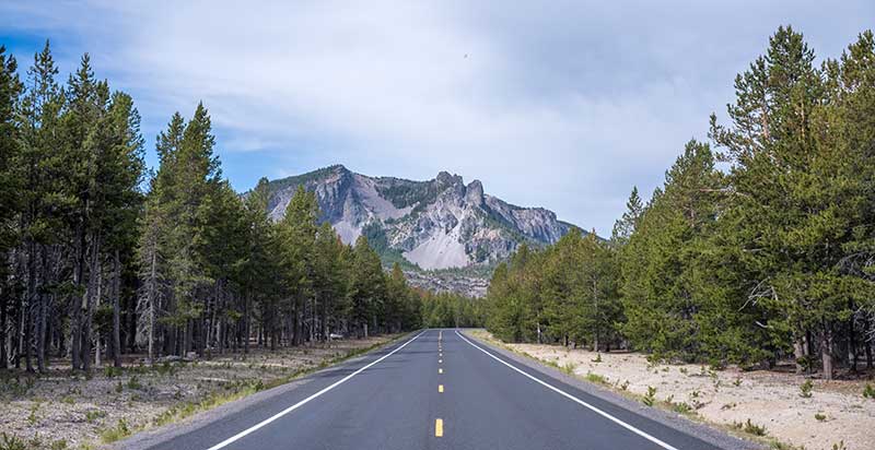
Paulina Peak above Newberry Caldera. Photo by Jeremy Nolan.
A long descent delivers riders into the town of La Pine, where a collection of restaurants, grocery stores, and hotels line US Highway 97. Aside from limited provisions at Crescent Lake Junction, this is the last opportunity to restock food for 86 miles (138 km) until Oakridge. The highway is busy but features wide shoulders and is used only briefly before the route turns back into Deschutes National Forest.
To the west, Diamond Peak dominates the skyline, rising to an elevation of 8,748 feet (2,584 m). Riders will pedal directly toward this dormant shield volcano, which last erupted sometime between 11,000 and 100,000 years ago. Evidence of this volcanic activity is visible along the route, particularly in the stark lava flows and a large, red-hued cinder quarry.
Beautiful camping, lodging, and swimming are available at Odell Lake and Crescent Lake just east of Diamond Peak. Beyond the lakes, the route passes several scenic backcountry ponds near Summit Lake. Numerous campsites are scattered throughout the area, but these ponds attract prolific mosquitoes, so bug spray is highly recommended.
The route enters the Willamette National Forest and begins a series of climbs around the western flank of Diamond Peak, passing several trailheads that disappear into the Diamond Peak Wilderness. Along this stretch, the landscape shifts noticeably as riders leave the dry interior of central Oregon and crest the Cascades. Moss and ferns thicken along the roadside, and the air grows cooler and more humid. From this point westward—except along high ridgetops—water is plentiful in cold mountain streams and rivers.
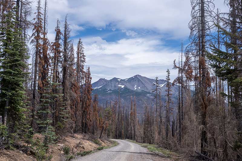
A recently burned area near Diamond Peak. Photo by Jeremy Nolan.
A long, fast, mostly paved descent delivers riders into the town of Oakridge. The small town offers solid resupply options, including a well-stocked mercantile with a bike shop, mechanic services, parts, and outdoor gear to help prepare for the next 85 miles (137 km) to Glide. The route loops through downtown, crossing the Middle Fork Willamette River at Greenwaters Park before continuing onto a short stretch of smooth, flat singletrack. It then returns to pavement to trace the western arm of Hills Creek Lake, where waterfront camping is available at Packard Creek Campground.
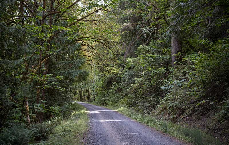
Lush, green forest near Oakridge. Photo by Jeremy Nolan.
The following stretch to Glide features two nearly identical climbs and descents in both mileage and elevation gain/loss. Each is long, steep, and beautiful. The climb from Hills Creek Lake begins on gravel before transitioning to a winding, single-lane paved road at the summit. The descent follows Brice Creek through the Umpqua National Forest, where several campgrounds are tucked into the cool, quiet forest among cedars and ferns. Inviting pools of crystal-clear water offer excellent opportunities for swimming and wading. Riders should take some time to familiarize themselves with poison oak, as it becomes increasingly prevalent from this point onward.
The route continues to the Row (pronounced like “cow”) River and passes Wildwood Falls, a 15-foot (4.5m) waterfall and popular swimming hole among locals. No services are available in Culp Creek, but riders interested in a fun sidetrip can follow the Row River Trail 17 miles (27 km) west to the fully serviced town of Cottage Grove. This paved, multi-use National Recreation Trail follows the former Oregon Pacific & Eastern Railroad along the scenic shores of the Row River and Dorena Reservoir, and served as a filming location for several scenes in the classic 1986 film Stand By Me.
Many of the small backcountry roads from this point west are paved to help maintain the road surface year-round for logging traffic. Riders should stay alert for logging trucks and equipment on these narrow, winding roads.
From Culp Creek, the route enters a checkerboard of BLM-managed land and a maze of logging roads. During the descent into Glide, riders will pass through a stark landscape shaped by recent wildfires. Dispersed camping is available along Rock Creek, but the burned trees provide little shade, so expect this section to be hot and sunny.
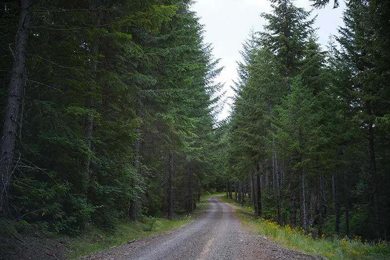
A ride through the trees. Photo by Jeremy Nolan.
OR Highway 138 follows the North Umpqua River into Glide and has narrow shoulders, with traffic occasionally heavy from the Roseburg area. Glide is small but offers a handful of restaurants and convenience stores to sustain riders for the next 98 miles (158 km) to Glendale.
No summer bike ride through Oregon would be complete without frequent stops to forage wild blackberries along the roadside. Most of the blackberries commonly seen in the state today are not native, having been introduced from Europe in the late 1800s. The descent into Glide is especially abundant with blackberry bushes, just be sure to watch for thorns!
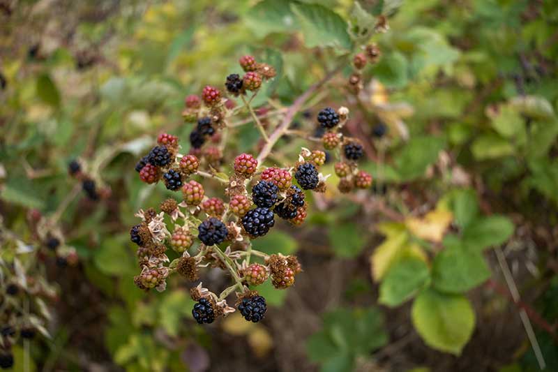
Wild blackberries provide a sweet snack for hungry cyclists. Photo by Jeremy Nolan.
South of Glide, the route continues through checkerboard BLM land, dipping back into Umpqua National Forest for several short stretches. The historic Cavitt Creek Covered Bridge carries the route across Little River and is worth stopping to admire its timber construction. Camping and swimming are available at Cavitt Creek Recreation Site, though reservations must be made at least five days in advance.
Cavitt Creek Covered Bridge south of Glide. Photo by Jeremy Nolan.
A significant gravel climb carries the route over a divide at Red Top Pond before descending to the South Umpqua River at Tiller. Beyond Tiller, a series of short, steep, alternating paved and gravel backcountry roads bring the route to the Interstate 5 corridor near Azalea, where a few basic services are available near the highway exits. Glendale is the final resupply point before the route’s 99-mile (159 km) push to the western terminus at Port Orford.
The remaining miles to the Pacific Ocean carry riders through the heart of Oregon’s Coastal Mountain Range. Receiving between 60 and 120 inches (150-300 cm) of rainfall annually, the Coast Range is one of the wettest regions in the continental United States. This abundant precipitation supports lush temperate rainforests and has made the region a hub of the Pacific Northwest timber industry. Logging has been widespread since the late 1800s, with large-scale clearcutting declining after the 1990s due to environmental regulations and endangered species protections. Timber harvests remain active, particularly on private industrial lands and some state-managed forests.
Despite traveling through a very remote portion of Oregon, most of this section is actually paved. Many of the surrounding gravel roads do not connect, are privately owned, or are actively logged and closed to the public. Gravel enthusiasts need not worry, however— these narrow, one-lane paved roads offer the same solitude and minimal traffic riders have come to appreciate since leaving the Mississippi River, but without the rough riding surfaces.
Leaving Glendale, the route follows Cow Creek Road, paralleling an important rail line constructed largely by Chinese immigrant laborers in the late 1800s. Camping is available at the BLM-managed Skull Creek Campground.
A steep climb brings riders onto a high ridgeline that the route follows for the next 16 miles (26 km), offering expansive views of the surrounding mountains. Here, riders may catch their first glimpse of the Pacific Ocean—or, more likely, a bank of fog pressed against the final ridges of the Coast Range.
The roadway darkens considerably as riders descend into temperate rainforest along the South Fork Coquille River within Rogue River-Siskiyou National Forest, where dense undergrowth and thick canopies overhead block much of the sunlight. Several quiet campgrounds are located along the river in this shaded, secluded stretch. A short but steep hike leads to Coquille River Falls, a beautiful multi-tiered waterfall set among an impressive stand of old-growth Douglas-fir, hemlock, and cedar trees.

The shaded forest between Glendale and Port Orford. Photo by Jeremy Nolan.
The route returns to gravel for the final climb around Iron Mountain, tracing the southern boundaries of the Copper Salmon Wilderness and Grassy Knob Wilderness. Additional camping is available at Laird Lake and, once the road returns to pavement, along the Elk River.
At US Highway 101, the route joins the Pacific Coast Bicycle Route for the final miles to Port Orford. The highway features wide shoulders but can be busy with traffic. Port Orford offers food and lodging, with excellent camping available a few miles north at Cape Blanco State Park and south at Humbug Mountain State Park.
The Golden Gravel Trail culminates in Port Orford at Battle Rock Wayside Park, perched on a bluff overlooking the vast Pacific Ocean. A steep path leads down to a driftwood-strewn beach, where riders can walk their bikes to the waves, dip their tires in the water, and savor the triumph of completing a 3,800-mile (6,100 km) journey—conquered entirely on two wheels.
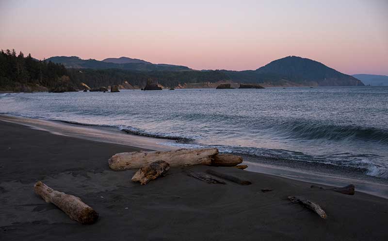
Driftwood on the beach at Port Orford. Photo by Jeremy Nolan.
CLIMATE
Starting in Payette, Idaho, the route winds through agricultural valleys surrounded by dry, grassy hills. Summers are hot, with daytime temperatures often climbing into the 90s°F (30s °C). Crossing into Oregon toward Huntington and Malheur Reservoir, the landscape opens into arid, high desert. The air is dry, the sun relentless, and water scarce. Shade is rare, and sudden winds can sweep across the wide, open valleys without much warning.
The forest returns with elevation, bringing cooler temperatures as the route climbs into the Strawberry Mountains, before descending briefly into the John Day Valley and then rising once more into the high terrain of the Aldrich and Ochoco Mountains. Mitchell marks a drop in elevation, followed by another ascent into the Ochocos on the approach to Prineville.
Leaving Prineville, the high desert is interspersed with dry volcanic plateaus, sagebrush, and pine flats. The sun is still strong, but temperatures decrease at the higher elevations near Newberry Volcano, where mornings can be chilly even in midsummer, and rain showers or sudden storms are possible.
Crossing the Cascades and Coast Range toward Oakridge, Glide, and Glendale, the climate shifts dramatically. The air grows cooler and moister, and dense forests begin to capture clouds and rainfall, though logging clearcuts and burn scars sometimes leave stretches exposed. Summers here are generally mild and comfortable for cycling, but as the route nears the coast, the likelihood of rain rises, and coastal fog often drifts in from the ocean.
PUBLIC LANDS & CAMPING
This route travels extensively on public land within the Bureau of Land Management (BLM) and the Malheur, Ochoco, Deschutes, Willamette, Umpqua, and Rogue River-Siskiyou National Forests administered by the US Forest Service (USFS). There is an abundance of established campgrounds along the route, ranging from reservable sites with RV hookups and showers, to first-come-first-served sites with fire rings and vault toilets. Campgrounds are open seasonally and open/close dates will vary. Contact Ranger Districts to confirm status, especially in the shoulder season. To make reservations or get more information on individual US Federal campgrounds, call 877-444-6777 or visit www.recreation.gov.
In addition to established campgrounds, it is legal to camp on USFS and BLM land for free following the guidelines found here: advcy.link/dispersecamp and advcy.link/blmdispersecamp.
REMOTE RIDING CONDITIONS
Many wild, remote stretches exist along this route. Extreme temperatures, inclement weather (including severe thunderstorms, flooding, snow, and extremely strong winds), wildfires, and other potential hazards are possible. Understand in advance how to prepare for and cope with them.
Individual water sources are only marked on the map where water is scarce or not obvious. Be prepared and plan accordingly. The areas of greatest concern are between Huntington and the Little Malheur River, and between Prineville Reservoir and East Lake at Newberry Volcano. Elsewhere, water resupply is generally straightforward with some planning, especially west of La Pine where water in creeks and rivers is plentiful.
Pack along bug repellent, sunscreen, and a first-aid kit. Few bike shops are available, and riders should be prepared for any mechanical possibility. At minimum, carry bicycle tools, a tire pump, and spare tubes, even if riding tubeless.
Most of this route is in black bear country. Always be bear-aware, and follow these rules when camping (these will help ward off other unwanted visitors too, such as raccoons and mice):
- Store all food, garbage, and other attractants in a bear-resistant manner, well away from your tent. This can include hanging them in a stuff sack from rope slung over a high, isolated tree branch, or storing them in a bear-proof container provided at campgrounds.
- Attractants such as food leftovers, fish entrails, and bacon grease should not be buried or burned in campfires. Leftover food and waste should be placed in a sealed bag or container and packed out with garbage. If leftover food or other attractants must be burned, do so in a contained cookstove or in an appropriate container over a campfire, then pack out the ash.
We discourage you from attempting to ride this route solo; in fact, a minimum group size of three is strongly recommended. If a rider is debilitated in the backcountry, you will want to have at least one person to stay with the injured/sick rider, and another to go for help. Be aware that cell phone reception is very spotty along much of the route, and it is recommended to carry a satellite phone in case of emergency.
LAND ACKNOWLEDGEMENT
As we travel by bicycle through these lands, we pause to reflect on our relationship with this place. We ride with respect and honor for the Indigenous peoples who have stewarded these mountains, forests, and waters since time immemorial. We commit to caring for this land by staying on paths, leaving no trace, and listening to the wisdom of the Indigenous peoples, including the Shoshone-Bannock, Northern Paiute, Cayuse, Umatilla, Walla Walla, Klamath, Nez Perce, Confederated Tribes of the Warm Springs, Confederated Tribes of the Grand Ronde, Confederated Tribes of Siletz, Umpqua, Coquille, and others who call these territories home. May your journey be guided by respect, gratitude, and responsibility.
ACKNOWLEDGEMENTS
Special thanks to Jeremy Nolan for scouting this route during the summer of 2025. Jeremy’s notes, insights, and recommendations were invaluable in the creation of this section of the Golden Gravel Trail.
Updates to Recently Released Maps
If you are planning a bike tour, be sure to get the most recent map updates and corrections for your route by selecting the route, and the appropriate section(s), from the drop-down menu below.
Over time maps become less useful because things change. Every year Adventure Cycling’s Routes and Mapping Department create map updates and corrections for every map in the Adventure Cycling Route Network, which now totals 52,047 miles. With the help of touring cyclists like you, we receive updates on routing, services, camping, and contact information. Until we can reprint the map with the new information, we verify the suggested changes and publish corrections and updates here on our website.
PLEASE NOTE: Covid has been particularly hard on the small businesses along our routes. While we do our best to keep the maps and these online updates current, you may encounter more closed businesses and longer stretches with limited or no services.
Refer to these updates for the most current information we have and submit reports of changes to the Route Feedback Form for the cyclists coming after you.
NOTE: Map updates and corrections only pertain to long term changes and updates. For short term road closures, please see the Adventure Cycling’s Routes Temporary Road Closures discussion in our Forums.
No route data found